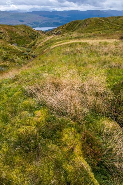
The showpiece peak is Ben Lawers, the 10th highest Munro in Scotland at 1,214m (3,984ft). The summit offers superb views over Loch Tay, westward to Ben Lomond and Glencoe, and a glimpse of the peaks of the Cairngorms to the north. Wildlife abounds, including black grouse, red deer, ptarmigan, and ravens.
Though many people are attracted to the reserve to climb Ben Lawers itself, the mountain is only one of the attractions to enjoy.
Visiting Ben Lawers
The easiest way by far to access the nature reserve is from the National Trust for Scotland parking area on the minor road from Edramucky (on the A827) to Bridge of Balgie in Glen Lyon. The road is well signposted off the A827 from the east and west approaches (i.e. from Kenmore and from Killin). After about 2 miles of switchbacks and steadily climbing the lower slopes of Ben Lawers you come to the parking area on your left.

Note that it is extremely easy to miss the parking area if you are coming from Bridge of Balgie to the north. We drove past the entrance and never knew it was there until we managed to turn around several miles further on and retrace our steps. From the south it is very easy to find the parking area.
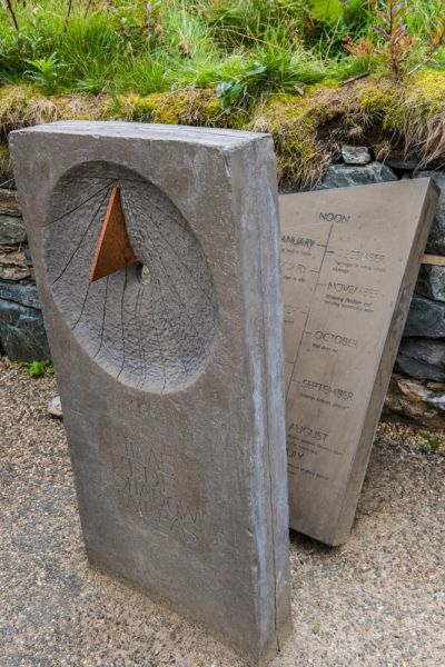
At the parking area is a small open-air exhibition about the nature reserve and its eco-system, along with an information panel and map overview. Here you will also find dispensers with free leaflets about the reserve and about the nature trail. I highly recommend taking one of the nature trail leaflets, especially if you don't plan to climb the mountain itself, as the leaflet does an extremely good job of explaining the flora and fauna you find about you in the reserve.
Please do not rely on the overview map to help you climb Ben Lawers. Take a detailed Ordnance Survey map with you and dress for any eventuality. The weather can change abruptly at high altitudes, even if it is sunny when you start. Good waterproof footwear is a must.
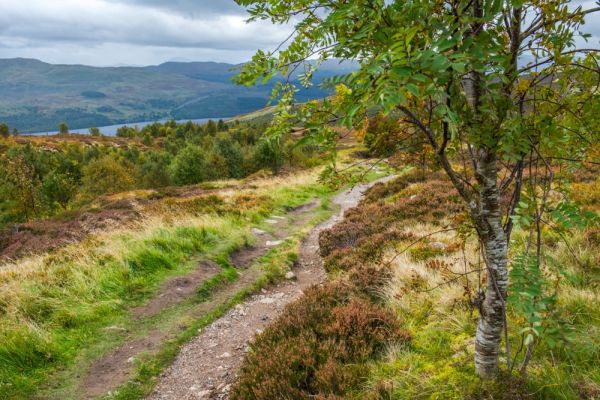
From the main parking area, a well-travelled footpath leads across the road, heading uphill towards Beinn Ghlas. You can't actually see the summit of Ben Lawers until you climb past Beinn Ghlas.

Edramucky Nature Trail
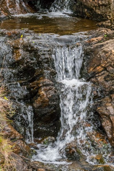
After 5 minutes walk the trail comes to a fenced area where the NTS have constructed the Edramucky Trail, a nature trail following the course of Edramucky Burn. The trail is designed to help visitors enjoy some of the unusual flowers and wildlife that inhabit the lower slopes of the mountain.
Just inside the fence, the trail splits, with the righthand fork following the nature trail and the lefthand fork heading uphill towards Ben Lawers.
The Edramucky Nature Trail is a 1-mile loop, with an optional 1-mile extension to the ruins of old shielings beside Coire Odhar. So if you take the entire nature trail and walk to the shielings it will be a total of 2 miles, with a total ascent of 660 feet. Allow roughly 90 minutes for the lower loop plus another 60 minutes if you extend your walk to include the shielings. That's a total of roughly 2 1/2 hours, which is a lot less than the 5-6 hours it will take to climb to the summit of Ben Lawers and return by the same path.

We visited the nature reserve on a wet, windy day in autumn when the summit was shrouded in rain clouds. We'd planned on hiking to the top of the mountain but that seemed a foolish idea given the weather conditions, so we settled for exploring the Edramucky Nature Trail. It was a surprisingly enjoyable experience, given the increasingly foul conditions.
The nature trail leaflet is exceptionally good, with sections related to numbered signposts beside the trail. Each signpost is set beside an area that illustrates a different aspect of the natural ecology of Ben Lawers. For example, the first stop is a boggy area where a boardwalk takes you over an area of peat where cotton grass and marsh willowherb flourish.
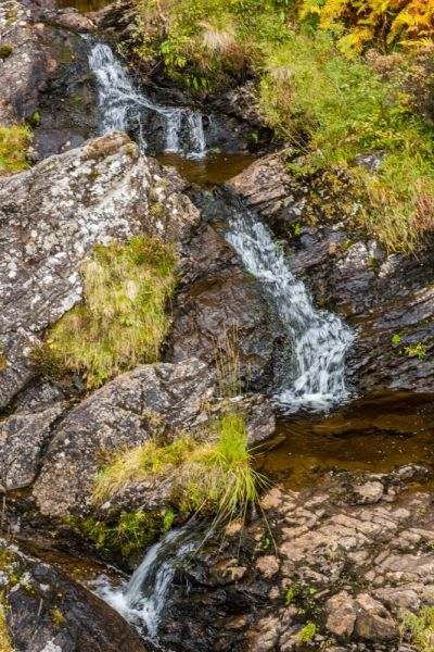
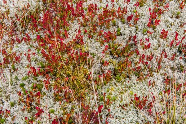
Along Edramucky Burn you can see areas of exposed bedrock, where richly coloured mountain plants grow. Mountain willow grows among the boulders in the burn.
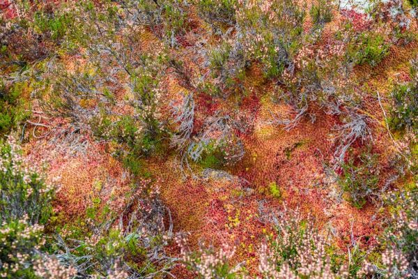
At signpost number 6 you can see a remarkably colourful array of sundew. If you look closely you can see that these little plants have reddish spikes protruding from their leaves. These spikes are sticky and used to catch insects, much like a miniature flytrap. Mosses abound, including the alpine clubmoss and stags-horn clubmoss.

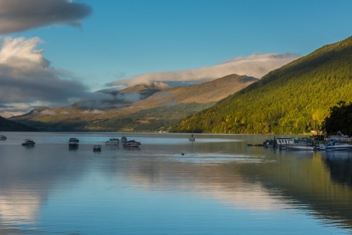
As you climb beside the burn you can look back for wonderful views over Loch Tay to the south.
At signpost number 10 the path turns back towards the parking area. Here you have the option of turning off to your right and following a rough track north to the ruins of shielings. These rough stone buildings were used by shepherds from the 14th-17th centuries.
The path to the shielings is very wet in places so I can't stress the need for good waterproof footwear enough. How enjoyable the experience is may depend on the time of year; when we visited the shielings in late September the rectangular stone buildings were completely buried beneath heavy layers of turf and moss, making them almost impossible to see until you were almost on top of them.
The turf made it quite difficult to really get a sense of the buildings' structure or to imagine what they must have looked like when they were in use. The rough terrain and bleakly beautiful mountain slopes would have made it a very difficult place to inhabit.

Lawers Dam
Of course there is more to the reserve than the nature trail and the summit trail, but those are the places most visitors will head for first. If you go further north along the road to Bridge of Balgie you will come to a second parking area near Lochan na Lairige, a picturesque loch set against a backdrop of stony hills. At the southern end of the loch is the Lawers Dam, built in 1951 as part of the Breadalbane Hydro-Electric Scheme.
The dam is 344m long and 42m high. It was built to create a reservoir to feed water down to the Finlarig power station at the west end of Loch Tay. There is a large parking area immediately beside the dam so you can pause to get a good look at this impressive piece of engineering.
I hope that the photos accompanying this article give some idea of the incredibly beautiful - and at times incredibly bleak - landscape of the Ben Lawers Nature Reserve. I can't wait to come back.