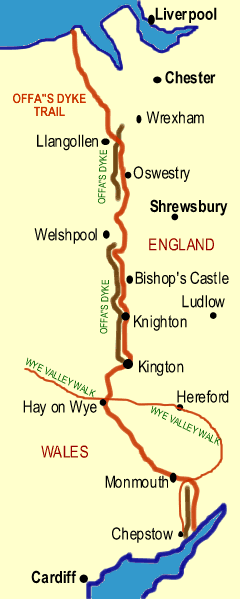
Chepstow to Prestatyn
A fascinating if sometimes challenging path along the English/Welsh border via Hay, Knighton and Llangollen. The trail passes 80 miles of the 8th century dyke and earthen wall built by the Anglo-Saxon King Offa of Mercia (AD 757-796) to protect his territory from marauding Welsh raiders.
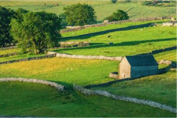
The bank reaches 20 feet in height in some sections, even after the wear and tear of 12 centuries. The dike is not continuous - either it was never finished or Offa decided to use natural geographic obstacles to deter the Welsh and save his people extra work! The wall is most impressive around Knighton.
The trail closely follows the border between Wales and England, and indeed crosses from one to the other nine times.
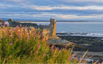
Beginning at Chepstow, the path climbs a ridge and then follows the River Wye past the ruins of Tintern Abbey, then on to the fortified town of Monmouth with its Norman Castle and the famous Bridge Gatehouse. Ten miles further along the ruins of the moated 12th century White Castle are directly on the path.
The path then climbs Haterall Ridge, some 1000 feet high. The views are superb, but then there is a steep descent into picturesque Hay-on-Wye. The town is pretty enough, but it is more famous as the used book capital of Britain, with numerous second-hand and speciality book shops lining its streets.
The earthworks of Offa's Dyke are most noticeable around Knighton, which is home to the Offa's Dyke Association (see contact info below). The way is rough just north of Knighton, but then the path descends into the level ground of Montgomery Plain. There the path follows the course of an old Roman road past the Iron Age earthworks of Beacon Ring Settlement and then along the Montgomery Canal towpath. Powis Castle in Welshpool is just off the path.
The trail then follows the Severn River past Chirk Castle (an optional detour takes visitors directly to the castle) and on to the Dee Valley, where an aqueduct carries the Telford Canal over the river. The ruins of Castle Dinas Bran hover over the pretty village of Llangollen.
The going is steep and fairly rough through the Clwydian Hills - though the superb views provide compensation for your efforts - to the final end of the path at Prestatyn on the Irish Sea.
Length
168 miles (270km)

Highlights:
Offa's Dyke 8th-century earthworks
Chirk Castle
Powis Castle
Tintern Abbey
Iron Age earthworks and ruined castles
Youth Hostels: St Briavel's Castle, Monmouth, Capel-y-ffin, Clun Mill
Maps
Ordnance Survey maps covering the Offa's Dyke Path:
Explorer OS maps (Scale: 4cm = 1 km / 1: 25000) - best for walking
013, 014, 201, 216, 240, 256, 265
Landranger OS maps (Scale: 2cm = 1km / 1: 50000)
LR 116, LR 117, LR 126, LR 137, LR 148, LR 161, LR 162
All OS maps are available at 10% off the retail price, by special arrangement if you order through Britain Express. Both laminated and plain paper maps are available.
Useful Contacts
Offa's Dyke Association
Offa's Dyke Centre
West Street
Knighton
Powys
LD7 1EW
Website: https://offasdyke.org.uk/
Offa's Dyke Accommodation and Services Guide - an online accommodation booking agency catering to walkers along the path.
Byways Breaks - Accommodation booking and luggage transfer service for walkers on Offa's Dyke Path.