Thames Head, Gloucestershire, to Thames Barrier, London
The Thames Path is a splendid riverside trail pioneered by David Sharp and the Rambler's Association, stretching 180 miles (288 km) along the River Thames. The path leads from the origin of the Thames in the foothills of the Cotswolds to the capital, passing through a wealth of fascinating riverside scenery and towns such as Oxford, Henley, and Windsor.
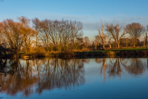
For much of its length, the Thames Path closely follows the ... well, yes, the River Thames. The river itself has been called "liquid history", but quite apart from its historical associations - which are many - the Thames Valley provides generally easy walking through water meadows and lovely riverside villages. Due to the challenges of obtaining rights of way, the path is forced to cross the river numerous times.
The first half of the path, as far as Oxford, wanders through quiet, open countryside, and you may find there are more cows keeping you company than there are fellow walkers. After Oxford, the villages get more numerous, and larger, until you reach the sprawl of Greater London.
The path splits in two at London, with a branch on each bank of the river, and both branches carry on through the city as far as the Thames Barrier near Greenwich.
Highlights
The Cotswolds countryside
Oxford - the historic 'city of dreaming spires'
Henley-on-Thames - home to the world's premier regatta
Runnymede - where the Magna Carta was signed
Windsor - home to the royal residence at Windsor Castle
Hampton Court Palace - superb Tudor palace begun by Cardinal Wolsey
Ham House - a red-brick mansion built in 1610 by the Earl of Dysart
The Thames Barrier - a striking modern flood control barrier

Maps
Ordnance Survey maps covering the Thames Path National Trail:
Landranger OS maps (Scale: 2cm = 1km / 1: 50000) The following maps will cover the entire Thames Path:
163 Cheltenham & Cirencester
164 Oxford
174 Newbury and Wantage
175 Reading and Windsor
176 West London
177 East London
Explorer OS maps (Scale: 4cm = 1 km / 1: 25000) - best for walking - These larger scale maps include more detail than the Landranger maps above, including field boundaries, which can be a very useful aide when navigating the trail. The following maps will cover the entire Thames Path:
160 Windsor, Weybridge and Bracknell
161 London South
162 Greenwich + Gravesend
168 Stroud, Tetbury and Malmesbury
169 Cirencester and Swindon
170 Abingdon, Wantage and Vale of White Horse
171 Chiltern Hills West
172 Chiltern Hills East
173 London North
180 Oxford
All OS maps are available at 10% off retail price, by special arrangement if you order through Britain Express. Both laminated waterproof and plain paper maps are available.
Guidebooks & Accommodation
The Thames Path - National Trail Guide by David Sharp. Aurum Press.
Thames: The River and The Path: Detailed Map by John Hale, Geoprojects
The Thames Path National Trail Companion by National Trails Office
Stillwell's National Trail Companion by Tim Stillwell and Dean Conway, Stillwell Publications, - lists accommodation on and near national trails throughout the UK and Ireland
The Rambler's Yearbook and Accommodation Guide published by the Rambler's Association - lists accommodation and walking resources.
Contacts
National Trails Office
Speedwell House
Oxford
OX1 1NE
Email: Thames.Path@oxfordshire.gov.uk
Web: Thames Path
Ramblers Association
2nd Floor, Camelford House
87-90 Albert Embankment
London, SE1 7TW
Web: www.ramblers.org.uk/