Countryside attractions in Bedfordshire
- Map of Countryside in Bedfordshire
- Map of ALL Countryside in England
- Map of all attractions in Bedfordshire

Aspley Wood
The wood is one of the largest remaining stretches of woodland in Bedfordshire, and offers miles of paths for walking and horse riding, as well as views over Woburn Abbey and Milton Keynes.
Location: Longslade lane just off the A5130.
Brogborough Hill
A picnic site just outside the Marston Vale Community Forest with easy access to forest walks and an orienteering course. Excellent views over Marston Vale. Tel the Forest Office at (01234) 767037.
Location: just off A421 near Jct. 13 on the M1
Dunstable Downs
Part of the Chilterns Area of Outstanding Natural Beauty (AONB), the Downs command excellent views over the Vale of Aylesbury and offer a popular area for kite and glider flying. There is a Countryside Centre offering interpretive exhibits and kites for sale.
Location: on the B4541 between Dunstable and Whipsnade.
Harrold-Odell Country Park
A bird-rich park set around two attractive lakes, with excellent walking along riverbanks and watermeadows. The Grebe Lake walk is suitable for wheelchairs, and a children's program operates from the Visitor Centre in the summer to orient youngsters to countryside enjoyment.
Location: between Harrold and Odell.
Henlow Common and Langford Meadows
This nature reserve outside Langford village near the River Ivel, offers excellent opportunities for wildlife watching and walks. The reserve provides a wide variety of natural landscape features, including scrub, pond, and grassland.
Location: on the A6001 south of Biggleswade. Access from Langford village.
Marston Vale Community Forest
Over 60 acres of woodland in the heart of Bedfordshire. The Countryside Agency administers the forest, with walking and cycling trails through the woods, and a visitor centre with an art gallery and recreational facilities.
Location: off the A421 at Marston Moreteyne.
Stewartby Lake Country Park
Formerly a clay pit, now a lake favoured by birds, in the midst of the Marston Vale Community Forest. A popular place for water sports.
Location: off the A421 between Bedford and Jct. 13 of the M1.
Stockgrove Country Park
Lake and woodland walks highlight this park set in a secluded valley. Bats converge on the lake in summer evenings. The lake walk is wheelchair accessible.
Location: on Great Brickhill road near Heath Reach. Small parking charge from 1000-1800.
Sundon Hills Country Park
A Site of Special Scientific Interest within the Chilterns AONB. Sundon Hills is one of the highest points in the county, and offers superb views, along with woodland walks through stands of beech and ash. The John Bunyan Trail passes through the park.
Location: between Upper Sundon and Harlington.
Totternhoe Knolls
A stretch of chalk grassland that offers a habitat to butterflies and a wide variety of chalk-loving plants. The site contains the remains of a Norman motte and bailey castle.
Location: just outside Totternhoe village.
Walks
Greensand Ridge Walk
The 40-mile long trail follows the wooded Greensand Ridge from Leighton Buzzard to Sandy. On the way, it passes through attractive wooded countryside and the parkland at Woburn. The Two Rivers Link is an 8-mile path connecting Greensand Ridge to the Icknield Way and Ridgeway Path at Ivinghoe Beacon.
Icknield Way Path
Part of the oldest track in Britain, the Icknield Way travels through the south Bedfordshire countryside on a 100-mile journey from Ivinghoe Beacon to the beginning of the Peddar's Way in Norfolk.
The Navigator's Way
A circular walk following the historic River Ivel Navigation Channel for 7 miles between Shefford and Stanford. Cockshoot Hill provides excellent views across the Ivel Valley.
Lea Valley Walk
Beginning at the source of the River Lea at Leagrave, the walk follows the Lea through Luton on its 50-mile journey to the Thames Bow Locks in London.
Clay Way Walk
An 11-mile walk following the West Bedfordshire Clay Ridge from Bromham Mill and Ridgemont, and skirting the edge of Marston Vale Community Forest.
The Skylark Ride
A series of horse-riding trails organized by the Ivel Valley Countryside Project, ranging from 6-20 miles. 80% of the trails are off-road. For details and pamphlets send an SAE to IVCP, Biggleswade Library, Chestnut Avenue, Biggleswade, Beds., SG18 0LL.
Stevington Country Walk
A 3-mile walk between Bromham and Stevington along the old Bedford - Northampton railway bed. Great views over the Ouse Valley.
Three Shires Way
A long-distance bridleway with walking and cycling access running for 37 miles from Grafham Water in Cambridgeshire to Tathal End in Buckinghamshire.
Marston Vale Community Forest Trails
Waymarked circular walks through the community forest.
The Kingfisher Way
A 21-mile long-distance walk along the banks of the River Ivel from its source near Baldock its junction with the Great Ouse at Tempsford. Easy railroad access allows the route to be tackled in separate sections.
Bedford to Sandy Country Way
The old Bedford to Sandy railroad bed is now open to walkers, cyclists, and wheelchairs between Bedford and the C56. Horses are allowed on the stretch between Bedford and Church End, Willington.
The Bedford Borough Council provides a variety of pamphlets detailing countryside recreational opportunities.
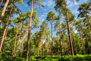
Aspley Wood is one of the largest remaining stretches of woodland in Bedfordshire and offers miles of paths for walking and horse riding, as well as views over Woburn Abbey and Milton Keynes.
Aspley Heath, Woburn, Bedfordshire, England
Heritage Rating: ![]() ?
?
Nearest Self Catering Cottages
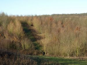
Brogborough Hill is a woodland area with a picnic site just outside the Marston Vale Community Forest, with easy access to forest walks and an orienteering course. Excellent views over Marston Vale.
Brogborough Hill Picnic Site, Brogborough, Bedfordshire, England
Heritage Rating: ![]() ?
?
Nearest Self Catering Cottages
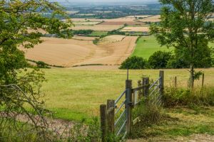
The Dunstable Downs form part of the Chilterns Area of Outstanding Natural Beauty (AONB). The Downs command excellent views over the Vale of Aylesbury and offer a popular area for kite and glider flying. There is a Countryside Centre offering interpretive exhibits and kites for sale.
Whipsnade Road, Dunstable, Bedfordshire, England, LU6 2GY
Heritage Rating: ![]() ?
?
Nearest Self Catering Cottages