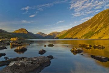
Ennerdale Water is one of the most remote of the major lakes in the Lake District, located in the north western corner of the National Park. There are two parking areas at the western end of the lake and a larger parking area where the road ends at Bowness Knott, on the northern shore. There, a short but steep ascent to the top of the Knott affords excellent views over the lake.
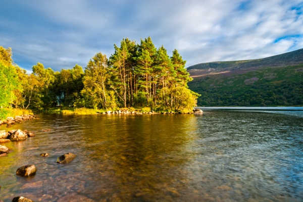
Even in the middle of summer, Ennerdale Water is likely to be the quietest and least busy lake in the Lake District. The lake is 2 1/2 miles in length, and half a mile wide at its widest point. The Forestry Commission began planting large tree plantations along the shores of Ennerdale Water as far back as the 1920s, making it much more heavily forested than other lakes in the National Park.
Waymarked trails skirt the lake, allowing circular walks of varying lengths from 3 to 10 miles, most passing through peaceful forest plantations. The best place to access the walking trails is at Bowness Knott. Above the lake are some of the most popular climbs in the Lake District, particularly Pillar Rock, one of the most challenging ascents in the park.
A few miles south of Ennerdale Bridge is Blakely Rise stone circle, a beautifully situated prehistoric monument.
About Ennerdale Water
Address: Ennerdale Bridge,
Lake District,
Cumbria,
England
Attraction Type: Countryside - Lake
Location: Access is via a minor road from Ennerdale Bridge, signposted from the A5092 between Cleator Moor and Cockermouth.
Location map
OS: NY105145
Photo Credit: David Ross and Britain Express
NEARBY HISTORIC ATTRACTIONS
Heritage Rated from 1- 5 (low to exceptional) on historic interest
Blakely Rise stone circle - 2.8 miles (Prehistoric Site) ![]()
Scale Force Waterfall - 3.2 miles (Countryside) ![]()
Crummock Water - 4.3 miles (Countryside) ![]()
Buttermere Lake - 4.7 miles (Countryside) ![]()
Wast Water lake - 6.3 miles (Countryside) ![]()
Scafell Pike Walk from Wasdale Head - 6.3 miles (Countryside) ![]()
Egremont Castle - 6.5 miles (Castle) ![]()
Gosforth, St Mary's Church - 7.1 miles (Historic Church) ![]()
Nearest Holiday Cottages to Ennerdale Water:

Cleator Moor, Cumbria
Sleeps: 13
Stay from: £1407.00 - 7985.00
More self catering near Ennerdale Water