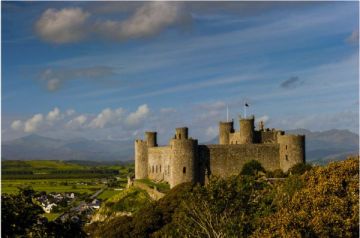
Roman sites in Gwynedd
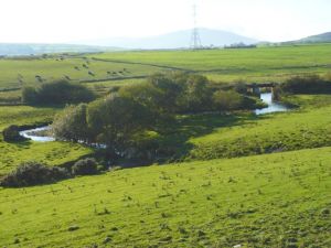
Aberffraw Roman Fort is a 1st-century Roman military fort, with two occupation phases. The site of the fort is underneath the current village.
Aberffraw, Anglesey, Gwynedd, Wales
Heritage Rating: ![]() ?
?
Nearest Self Catering Cottages

Earthwork remains of a 2nd century Roman fortlet lie in a beautiful setting east of Dolgellau. Archaeologists found evidence of lead smelting and tanning at the site, which was abandoned around AD 145. The outline of the fort can clearly be seen from the ground.
Brithdir, Dolgellau, Gwynedd, Wales
Heritage Rating: ![]() ?
?
Nearest Self Catering Cottages

Bryn-y-Gefeiliau is a small 1st-century Roman fort stood beside the River Llugwy in the scenic Llugwy Valley. The fort was occupied from about AD 90-120 and may have been built to control lead mining and smelting in the area.
Caer Lugwy, Betws-y-Coed, Snowdonia, Gwynedd, Wales
Heritage Rating: ![]() ?
?
Nearest Self Catering Cottages

Caer Gai is a 1st-century Roman earthwork fort, occupied until the mid-2nd century. According to tradition the fort was used by King Arthur after the Romans left Britain in the 5th century.
Caergai Farm, A494, Llanuwchllyn, Gwynedd, Wales
Heritage Rating: ![]() ?
?
Nearest Self Catering Cottages
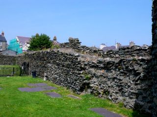
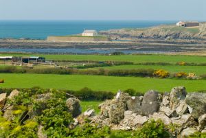
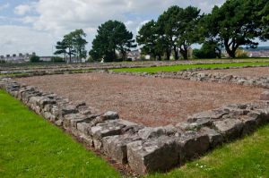
The walls are all that survive of Caer Gybi, a small Roman fort dating to the late 3rd century. The fort stands to the west of Holyhead harbour, and was built around 300 AD as a defence against Irish pirates.
Victoria Road, Holyhead, Anglesey, Anglesey, Gwynedd, Wales
Heritage Rating: ![]() ?
?
Nearest Self Catering Cottages

Caer y Twr is a late Roman watchtower built within the remains of an Iron Age hill fort on the east slope of Holyhead Mountain.
Holyhead, Anglesey, Anglesey, Gwynedd, Wales
Heritage Rating: ![]() ?
?
Nearest Self Catering Cottages
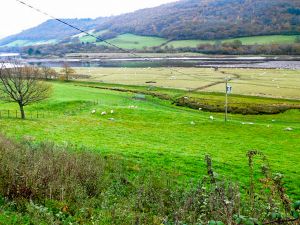
Canovium is a 1st-century fort built to guard a strategic crossing of the River Conwy. The first fort was built of earthwork banks and ditches, later rebuilt in stone. The fort was abandoned around AD 200 and then reoccupied until the late 4th century.
Caerhun, Tyn y Groes, Gwynedd, Wales, LL32 8UG
Heritage Rating: ![]() ?
?
Heritage Highlight: Medieval church built into one corner of the fort
Nearest Self Catering Cottages
Just east of Bala lies the site of a 1st century Roman marching camp, situated in farm fields on the floodplain of the River Dee.
Bala, Gwynedd, Wales
Heritage Rating: ![]() ?
?
Nearest Self Catering Cottages
Pen Llystyn is a Roman infantry fort with housing for roughly 1000 soldiers. It stands beside the Afon Dwyfach near Derwin Bach, just north of Bryncir, and is visible from the A487.
Bryncir, Gwynedd, Wales
Heritage Rating: ![]() ?
?
Nearest Self Catering Cottages
Segontium is a 1st-century Roman fort and museum. Stones from the fort were used by Edward I to build nearby Caernarfon Castle.
Constantine Road, Caernarfon, Gwynedd, Wales, LL55 2LN
Heritage Rating: ![]() ?
?
Nearest Self Catering Cottages