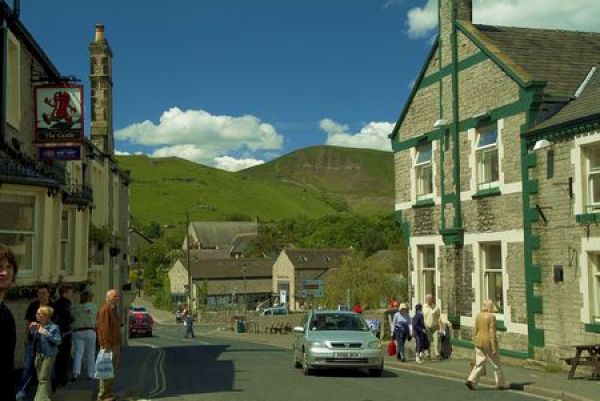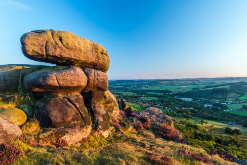
The Peak District marks the meeting of the soft southern landscape, with its light-coloured limestone, and the harsh grey gritstone lands to the north. The park lies close to the industrial sprawl of Manchester and Sheffield, and for this reason, it can be crowded at times.
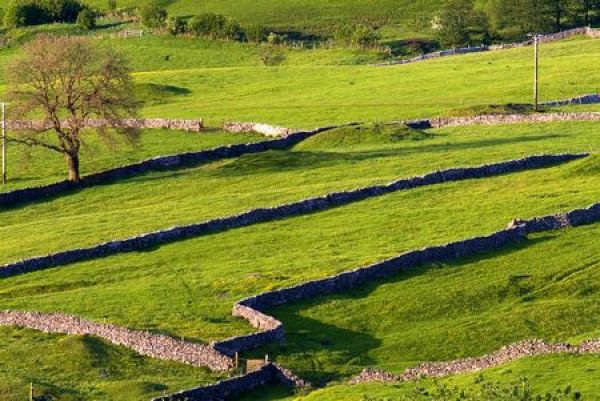
Yet for all its proximity to civilisation, the Peak District carries about it an air of timeless peace and tranquillity, with mile after mile of drystone walling sectioning the countryside into the familiar British chequerboard pattern.
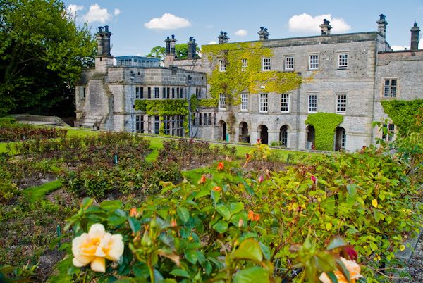
The River Dove splits the park near Tissington, famed for its ancient well-dressing celebrations. Better known perhaps, is the River Wye, which flows across the park, creating lovely views and good walking, particularly on the moors near Chee Dale, and Miller's Dale. Near Bakewell is Haddon Hall, one of Britain's most famous country houses.

What to see:
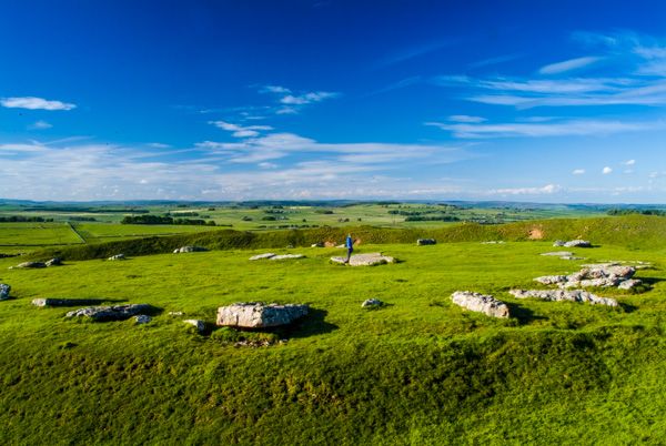
Arbor Low - Neolithic stone circle, one of the finest in all England.
Blue John Cavern - home of the rare gemstone which bears its name.
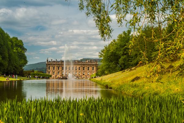
Chatsworth House - one of the great stately homes of England, home of the Duke and Duchess of Devonshire
Dovedale - the valley of the River Dove, Park near Ilam or Thorpe, and enjoy lovely walks - but beware crowds in the midday
Edale - the start of the Pennine Way
Eyam - the 'plague village'
, home to Eyam Hall, a superb 17th-century manor house
Haddon Hall - (Bakewell), There are Tudor and Jacobean underpinnings to this country house, the former seat of the Dukes of Rutland
Peveril Castle - a dramatic 11th-century ruined castle built by the illegitimate son of William the Conqueror
Walking trails at Monsal (Bakewell Station), Ashbourne, and Mam Tor.
Accommodation
Ordnance Survey maps covering the Peak District:
Explorer OS maps (1: 25000) - best for walking
Dark Peak - White Peak
Landranger OS maps (1: 50000)
LR110 Sheffield/Huddersfield - LR119 Buxton Matlock Dovedale
Contact
Peak District National Park
Aldern House, Baslow Road
Bakewell
Derbyshire
DE45 1AE
Tel: 01629 816 200
Web: www.peakdistrict.gov.uk/
More Photos