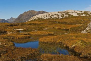
Prehistoric Sites in Scotland
Also see Ancient Sites in England | Wales
Map of all Ancient Sites in Scotland
| Name | Town | County | Organisation | Heritage Rating |
|---|---|---|---|---|
| Aberlemno Sculptured Stones | Forfar | Tayside | Historic Scotland | |
| Achavanich Standing Stones | Latheron | Highlands and Islands | ||
| Achcoillenaborgie Broch | Bettyhill | Highlands and Islands | ||
| Achmore Stone Circle | Achmore | Highlands and Islands | ||
| Achnabreck Cup and Ring Marks | Lochgilphead | Strathclyde | Historic Scotland | |
| Aikey Brae Stone Circle | Old Deer | Grampian | ||
| Allt Chrysal Ancient Settlement | Castlebay | Highlands and Islands | ||
| An Carra Standing Stone | Ormacleit | Highlands and Islands | ||
| Ardestie Earth-House | Monifieth | Tayside | Historic Scotland | |
| Auchagallon Stone Circle | Machrie | Strathclyde | Historic Scotland | |
| Auchencar Druid Standing Stone | Machrie | Strathclyde | ||
| Avinagillan Standing Stone | Tarbert | Strathclyde | ||
| Ballygowan Cup and Ring Marks | Kilmartin | Strathclyde | Historic Scotland | |
| Ballymeanoch Stone Row | Kilmartin | Strathclyde | ||
| Baluachraig Cup and Ring Marks | Kilmartin | Strathclyde | Historic Scotland | |
| Barnhouse Neolithic Settlement | Stenness | Highlands and Islands | ||
| Barochan Cross | Paisley | Strathclyde | Historic Scotland | |
| Barp Frobost chambered cairn | Frobost | Highlands and Islands | ||
| Barpa Langass Chambered Cairn | Clachan | Highlands and Islands | Historic Scotland | |
| Barsalloch Fort | Monreith | Dumfries and Galloway | Historic Scotland | |
| Beacharr Standing Stone | Killean | Strathclyde | ||
| Beinn a' Charra Standing Stone | Malacleit | Highlands and Islands | ||
| Bernera Bridge Stone Circle | Barraglom | Highlands and Islands | ||
| Berrybrae Stone Circle | Crimond | Grampian | ||
| Blackhammer Chambered Tomb | Tratland | Highlands and Islands | Historic Scotland | |
| Blackpark Standing Stones | Kingarth | Strathclyde | ||
| Bone Caves | Inchnadamph | Highlands and Islands | ||
| Borve Standing Stone | Borve | Highlands and Islands | ||
| Bostadh Iron Age House | Bostadh | Highlands and Islands | ||
| Brandsbutt Symbol Stone | Inverurie | Grampian | Historic Scotland | |
| Broch of Gurness | Aikerness | Highlands and Islands | Historic Scotland | |
| Brough of Birsay | Brough Head | Highlands and Islands | Historic Scotland | |
| Brough of Deerness | Deerness | Highlands and Islands | ||
| Brown Caterthun Fort | Edzell | Tayside | Historic Scotland | |
| Buaile Riabhach Stone Circle | Scalasaig | Strathclyde | ||
| Bucharn Cairn | Banchory | Grampian | ||
| Burghead Promontory Fort | Burghead | Grampian | ||
| Burghead Well | Burghead | Grampian | Historic Scotland | |
| Cairn Catto | Cruden Bay | Grampian | ||
| Cairn Holy Chambered Cairns | Creetown | Dumfries and Galloway | Historic Scotland | |
| Cairn o' Get | Ulbster | Highlands and Islands | Historic Scotland | |
| Cairn O'Mount | Fettercairn | Grampian | ||
| Cairnbaan Chambered Cairn | Glecknabae | Strathclyde | ||
| Cairnbaan Cup and Ring Marks | Cairnbaan | Strathclyde | Historic Scotland | |
| Cairnpapple Hill | Torphichen | Lothian | Historic Scotland | |
| Callanish Standing Stones | Callanais | Highlands and Islands | Historic Scotland | |
| Camas nan Geall Chambered Cairn | Kilchoan | Highlands and Islands | ||
| Camus's Stone | Duffus | Grampian | ||
| Candle Stane | Ellon | Grampian | ||
| Capo Long Barrow | Laurencekirk | Grampian | ||
| Carlungie Earth-House | Monifieth | Tayside | Historic Scotland | |
| Carn Ban | Lagg | Strathclyde | Historic Scotland | |
| Carn Liath Broch | Golspie | Highlands and Islands | Historic Scotland | |
| Castle Point Fort | Pennan | Grampian | ||
| Castlelaw Hill Fort | Castlelaw | Lothian | Historic Scotland | |
| Chesters Hill Fort | Drem | Lothian | Historic Scotland | |
| Clach A'Pheanais (Balnahard) Standing Stone | Balnahard | Strathclyde | ||
| Clach an Truiseil Standing Stone | Ballantrushal | Highlands and Islands | ||
| Clachtoll Broch | Clachtoll | Highlands and Islands | ||
| Clad Chiarain Burial Ground and Standing Stone | Kilchoan | Highlands and Islands | ||
| Claggain Bay Standing Stone | Port Ellen | Strathclyde | ||
| Clava Cairns | Newlands | Highlands and Islands | Historic Scotland | |
| Cleaved Head Promontory Fort | Macduff | Grampian | ||
| Clickimin Broch | Lerwick | Highlands and Islands | Historic Scotland | |
| Cnoc Freiceadain Long Cairns | Thurso | Highlands and Islands | Historic Scotland | |
| Coille na Borgie Chambered Cairns | Bettyhill | Highlands and Islands | ||
| Corrimony Chambered Cairn | Corrimony | Highlands and Islands | Historic Scotland | |
| Cowiemuir Cairn | Portgordon | Grampian | ||
| Cragabus Chambered Cairn | Port Ellen | Strathclyde | ||
| Craig Phadrig Hill Fort | Inverness | Highlands and Islands | Forestry Commission Scotland | |
| Craigberoch Standing Stone | Rothesay | Strathclyde | ||
| Crathie Point Promontory Fort | Sandend | Grampian | ||
| Croft Moraig Stone Circle | Aberfeldy | Tayside | ||
| Cullerlie Stone Circle | Garlogie | Grampian | Historic Scotland | |
| Culsh Earth-House | Culsh | Grampian | Historic Scotland | |
| Cultoon Stone Circle | Portnahaven | Strathclyde | ||
| Cuween Hill Chambered Cairn | Finstown | Highlands and Islands | Historic Scotland | |
| Dogton Stone | Kinglassie | Fife | Historic Scotland | |
| Doonhill Homestead | Dunbar | Lothian | Historic Scotland | |
| Drumtroddan Cup and Ring Marked Rocks | Port William | Dumfries and Galloway | Historic Scotland | |
| Drumtroddan Standing Stones | Port William | Dumfries and Galloway | Historic Scotland | |
| Dull Cross | Dull | Tayside | ||
| Dun Ban | Baymore | Highlands and Islands | ||
| Dun Beag Broch | Braccadale | Highlands and Islands | Historic Scotland | |
| Dun Bharpa Chambered Cairn | Craigston | Highlands and Islands | ||
| Dun Carloway Broch | Carloway | Highlands and Islands | Historic Scotland | |
| Dun Cuier | Cuidhir | Highlands and Islands | ||
| Dun Dornaigil Broch | Altnacaillich | Highlands and Islands | Historic Scotland | |
| Dun Eistean | Port of Ness | Highlands and Islands | ||
| Dun Gallain Hill Fort | Machrins | Strathclyde | ||
| Dun Nosebridge | Bridgend | Strathclyde | ||
| Dun Telve Broch | Conrary | Highlands and Islands | Historic Scotland | |
| Dun Troddan Broch | Conrary | Highlands and Islands | Historic Scotland | |
| Dun Vulan | Bornais | Highlands and Islands | ||
| Dunadd Fort | Kilmartin | Strathclyde | Historic Scotland | |
| Dunagoil Hill Fort | Kingarth | Strathclyde | ||
| Dunchraigaig Cairn | Kilmartin | Strathclyde | Historic Scotland | |
| Dunfallandy Stone | Pitlochry | Tayside | Historic Scotland | |
| Dupplin Cross | Dunning | Tayside | Historic Scotland | |
| Dursainean Chambered Cairn | Garrabost | Highlands and Islands | ||
| Dwarfie Stane | Quoyness | Highlands and Islands | Historic Scotland | |
| Dyce Symbol Stones | Dyce | Grampian | Historic Scotland | |
| Eassie Sculptured Stone | Eassie | Tayside | Historic Scotland | |
| East Aquhorthies Stone Circle | Inverurie | Grampian | Historic Scotland | |
| Edin's Hall Broch | Grantshouse | Borders | Historic Scotland | |
| Fingal's Limpet Hammers | Kilchattan | Strathclyde | ||
| Fordoun Stone | Auchenblae | Grampian | ||
| Fyvie Symbol Stones | Fyvie | Grampian | ||
| Garvard Standing Stone | Garvard | Strathclyde | ||
| Giants' Graves | Whiting Bay | Strathclyde | ||
| Glassel Dam Wood Stone Circle | Banchory | Grampian | ||
| Glebe Cairn | Kilmartin | Strathclyde | Historic Scotland | |
| Glebe Stone | Yarrow | Borders | ||
| Gourdon Cairn | Gordoun | Grampian | ||
| Grain Earth-House | Kirkwall | Highlands and Islands | Historic Scotland | |
| Gramsdale Standing Stones | Gramsdale | Highlands and Islands | ||
| Green Castle | Portknockie | Grampian | ||
| Grey Cairns of Camster | Roster | Highlands and Islands | Historic Scotland | |
| Hallan Roundhouses (Cladh Hallan) | Dalabrog | Highlands and Islands | ||
| High Keillor Pictish Symbol Stone | Kettins | Tayside | ||
| Hill o' Many Stanes | Wick | Highlands and Islands | Historic Scotland | |
| Holm of Papa Westray Chambered Cairn | Highlands and Islands | Historic Scotland | ||
| Innesmill Stone Circle | Urquhart | Grampian | ||
| Inveravon Symbol Stones | Inveravon | Grampian | ||
| Inverurie Symbol Stones | Inverurie | Grampian | ||
| Jarlshof Prehistoric and Norse Settlement | Sumburgh Head | Highlands and Islands | Historic Scotland | |
| Kensaleyre Standing Stones | Uig | Highlands and Islands | ||
| Kilbride Standing Stone | Port Ellen | Strathclyde | ||
| Kildonan Dun, Kintyre | Saddell | Strathclyde | ||
| Kilmichael Chapel | Glecknabae | Strathclyde | ||
| Kilmichael Glassary Cup and Ring Marks | Kilmichael | Strathclyde | Historic Scotland | |
| Kilpatrick Dun | Blackwaterfoot | Strathclyde | Historic Scotland | |
| Kilvaxter Souterrain | Kilvaxter | Highlands and Islands | ||
| Kinord Cross | Kinord | Grampian | ||
| Kintore Symbol Stone | Kintore | Grampian | ||
| Kintraw Standing Stone | Ardfern | Strathclyde | ||
| Knap of Howar | Holland | Highlands and Islands | Historic Scotland | |
| Knocknagael Boar Stone | Inverness | Highlands and Islands | Historic Scotland | |
| Knowe of Yarso Chambered Cairn | Frotoft | Highlands and Islands | Historic Scotland | |
| Laggangairn Standing Stones | New Luce | Dumfries and Galloway | Historic Scotland | |
| Lang Stane o'Craigearn | Kemnay | Grampian | ||
| Links of Noltland | Pierowall | Highlands and Islands | Historic Scotland | |
| Little Conval Fort | Dufftown | Grampian | ||
| Loanhead of Daviot Stone Circle | Daviot | Grampian | Historic Scotland | |
| Lochbuie Stone Circle | Lochbuie | Strathclyde | ||
| Logie Newton Cairns | Logie Newton | Grampian | ||
| Longman Hill Cairn | Macduff | Grampian | ||
| Loudon Wood Stone Circle | Mintlaw | Grampian | ||
| Lundin Links Standing Stones | Lundin Links | Fife | ||
| Machrie Moor Standing Stones | Machrie | Strathclyde | Historic Scotland | |
| Maclean's Cross | Iona | Strathclyde | Historic Scotland | |
| Maes Howe Chambered Cairn | Stromness | Highlands and Islands | Historic Scotland | |
| Maiden Stone | Inverurie | Grampian | Historic Scotland | |
| Marionburgh Cairn | Aberlour | Grampian | ||
| Memsie Cairn | Memsie | Grampian | Historic Scotland | |
| Midhowe Broch | Westness | Highlands and Islands | Historic Scotland | |
| Midhowe Chambered Cairn | Westness | Highlands and Islands | Historic Scotland | |
| Midmar Kirk Stone Circle | Echt | Grampian | ||
| Migvie Pictish Stone and Kirk | Migvie | Grampian | ||
| Mine Howe | Tankerness | Highlands and Islands | ||
| Mither Tap O'Bennachie | Chapel of Garioch | Grampian | ||
| Moness Cup-Marked Stone | Aberfeldy | Tayside | ||
| Mortlach Battle Stone | Dufftown | Grampian | ||
| Moss Farm Road Stone Circle | Blackwaterfoot | Strathclyde | Historic Scotland | |
| Mote of Mark | Rockcliffe | Dumfries and Galloway | ||
| Mousa Broch | Highlands and Islands | Historic Scotland | ||
| Ness Of Burgi Promontory Fort | Scatness | Highlands and Islands | Historic Scotland | |
| Nether Largie Cairns | Kilmartin | Strathclyde | Historic Scotland | |
| Nether Largie Standing Stones | Kilmartin | Strathclyde | ||
| Newton Stone | Inverurie | Grampian | ||
| Nine Stanes Stone Circle | Banchory | Grampian | ||
| Nybster Broch | Nybster | Highlands and Islands | ||
| Old Kinord Ancient Village | Kinord | Grampian | ||
| Picardy Symbol Stone | Insch | Grampian | Historic Scotland | |
| Pobull Fhinn Stone Circle | Clachan | Highlands and Islands | ||
| Pollachar Standing Stone | Pollachar | Highlands and Islands | ||
| Quarry Wood Henge | Elgin | Grampian | ||
| Quoyness Chambered Cairn | Highlands and Islands | Historic Scotland | ||
| Red Priest's Stone | Skail | Highlands and Islands | ||
| Reineval Chambered Cairn | Mingarry | Highlands and Islands | ||
| Rennibister Earth-House | Finstown | Highlands and Islands | Historic Scotland | |
| Rhynie Man | Aberdeen | Grampian | ||
| Rhynie Symbol Stones | Rhynie | Grampian | ||
| Ri Cruin Cairn | Kilmartin | Strathclyde | Historic Scotland | |
| Ring of Brodgar | Stenness | Highlands and Islands | Historic Scotland | |
| Rispain Camp | Whithorn | Dumfries and Galloway | Historic Scotland | |
| Rodney's Stone | Forres | Grampian | National Trust for Scotland | |
| Scalasaig Standing Stones | Scalasaig | Strathclyde | ||
| Shandwick Stone | Shandwick | Highlands and Islands | ||
| Skail Chambered Cairn | Skail | Highlands and Islands | ||
| Skara Brae Prehistoric Village | Skaill | Highlands and Islands | Historic Scotland | |
| South Clettreval Chambered Cairn | Tigharry | Highlands and Islands | ||
| St Bean's Church and Fowlis Wester Sculptured Stone | Fowlis Wester | Tayside | Historic Scotland | |
| St Colmac Cottages Stone Circle | St Colmac | Strathclyde | ||
| St Columba's Well | Balnahard | Strathclyde | ||
| St Michael's Grave | Glecknabae | Strathclyde | ||
| St Ninian's Bay Standing Stones | Straad | Strathclyde | ||
| St Orland's Stone | Forfar | Tayside | Historic Scotland | |
| Stanydale Temple | Walls | Highlands and Islands | Historic Scotland | |
| Steinacleit Stone Circle | Shader | Highlands and Islands | Historic Scotland | |
| Stones of Stenness Circle and Henge | Finstown | Highlands and Islands | Historic Scotland | |
| Stravanan Bay Stone Row | Kingarth | Strathclyde | ||
| Strichen Stone Circle | Strichen | Grampian | ||
| Sueno's Stone | Forres | Grampian | Historic Scotland | |
| Sunhoney Stone Circle | Echt | Grampian | ||
| Tap O' Noth Hill Fort | Rhynie | Grampian | ||
| Taversoe Tuick Chambered Cairn | Brinian | Highlands and Islands | Historic Scotland | |
| Temple Wood Stone Circles | Kilmartin | Strathclyde | Historic Scotland | |
| Templestone Stone Circle | Rafford | Grampian | ||
| The Doon Iron Age Hillfort | Blackwaterfoot | Strathclyde | ||
| The Macfie Stone | Scalasaig | Strathclyde | ||
| Tirghoil Standing Stone | Fionnphort | Strathclyde | ||
| Tobar Oran Sculptured Stone | Kiloran | Strathclyde | ||
| Tomb of the Eagles | St Margaret's Hope | Highlands and Islands | ||
| Tomnaverie Stone Circle | Aboyne | Grampian | Historic Scotland | |
| Torhouse Stone Circle | Wigtown | Dumfries and Galloway | Historic Scotland | |
| Torr a'Chaisteal Dun | Blackwaterfoot | Strathclyde | Historic Scotland | |
| Torrylin Cairn | Lagg | Strathclyde | Historic Scotland | |
| Totaig Broch | Letterfearn | Highlands and Islands | ||
| Tote Pictish Stone | Skeabost | Highlands and Islands | ||
| Tullich Symbol Stone | Tullich | Grampian | ||
| Tyrie Raven Stone | Tyrie | Grampian | ||
| Unstan Chambered Cairn | Stromness | Highlands and Islands | Historic Scotland | |
| White Caterthun Fort | Edzell | Tayside | Historic Scotland | |
| White Cow Wood Cairn | Mintlaw | Grampian | ||
| Whitehill Stone Circle | Monymusk | Grampian | ||
| Wideford Hill Chambered Cairn | Kirkwall | Highlands and Islands | Historic Scotland | |
| Wormy Hillock Henge Monument | Rhynie | Grampian | ||
| Yarrow Stone | Yarrow | Borders | ||
| Yarrows Archaeological Trail | Thrumster | Highlands and Islands | ||
| Yetnasteen Standing Stone | Yetnasteen | Highlands and Islands | ||
| Name | Town | County | Organisation | Heritage Rating |
Attraction search