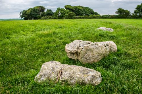
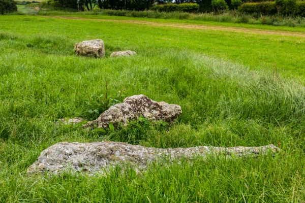
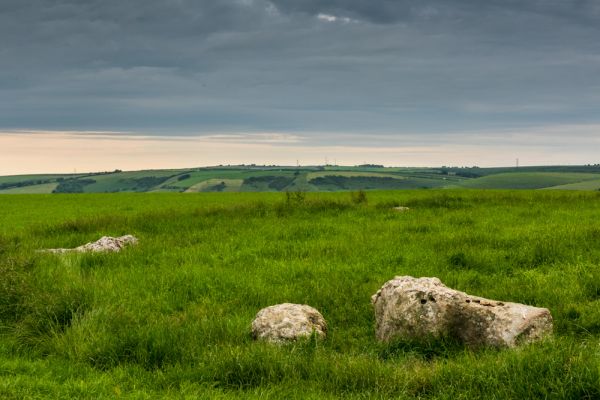
The Kingston Russell stone circle dates to the late Neolithic or early Bronze Age. The circle is composed of 18 stones, all fallen. The location is wonderful; the stone circle is set on a chalk hilltop with wide-ranging views towards the sea and nearby Abbotsbury village.
The circle is 30 metres in diameter, and the height of the stones varies from 1 to 2 metres -- though it is difficult to really get a sense of the height of the stones since they all lie flat on the ground.
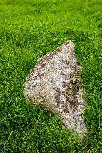
I wouldn't call Kingston Russell a particularly outstanding stone circle, but it is interesting. The stones lie in the middle of a farm field, not in the exposed hilltop location you usually find. And though the stones all lie flat on the ground they are of various sizes and shapes, which really makes you wonder why the builders chose those particular stones.
That's one of the fascinating things about Kingston Russell; the variety of shapes and sizes used for the stones. None of them appears to be similar, and I couldn't see any evidence that they were shaped or carved in any way.
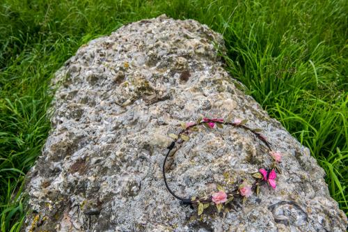
When I visited, someone had left a floral garland on one of the recumbent stones. It is fascinating that even after thousands of years people still treat stone circles with respect, even reverence, and make them a place for ritual observances.
Getting There
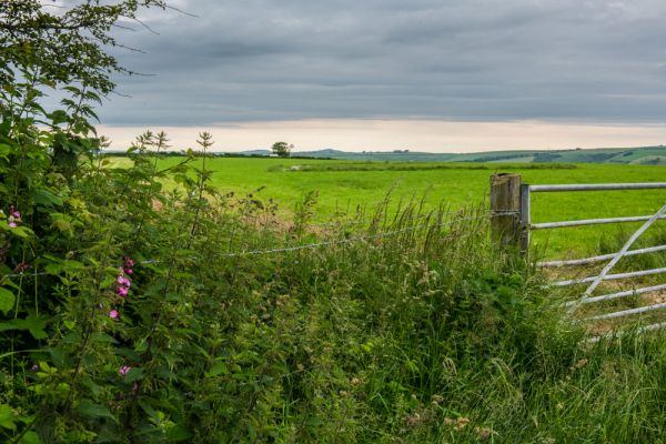
This is an open-access site, though a bit awkward to get to, and it is not signposted until you are almost on top of it. The site is 750 metres north-east of Gorwell Farm and the MacMillan Way long distance trail passes directly beside the site.
The best way to reach the circle is to take the minor road north from Portesham, signposted to the Hardy Monument. Where the road to the Monument goes off to the right, take the left-hand fork towards Abbotsbury. After a mile, just before a sharp left bend, there is a small lane off to the right towards Gorwell farm. There is space for 2-3 cars to park on the verge just before a cattle grid.
To the right of the cattle grid is a narrow lane, and leading off that is a signed footpath.
Follow the footpath for one mile as it runs parallel to the field boundary. Just where the trail joins the MacMillan Way you will see what appears to be a circular area of tall grass in the field to your right. If the grass is high you won't immediately see the fallen stones, so it won't at first glance look like a stone circle.
Be aware that in places the footpath is muddy, so hiking boots or some other kind of solid walking footwear is a good idea, especially after a rain.
It took me a solid hour to walk to the stone circle, photograph it, and walk back.
More Photos

About Kingston Russell Stone Circle
Address: Abbotsbury, Dorset, England, DT3 4JX
Attraction Type: Prehistoric Site
Location: 2 miles north of Abbotsbury. The circle is located on the MacMillan Way footpath. Not signposted. Use OS Landranger map LR194 (Dorchester/Weymouth)
Website: Kingston Russell Stone Circle
English Heritage - see also: English Heritage memberships (official website)
Location map
OS: SY577878
Photo Credit: David Ross and Britain Express
Opening Details: Open access site, usually accessible at any reasonable time
HERITAGE
 We've 'tagged' this attraction information to help you find related historic attractions
and learn more about major time periods mentioned.
We've 'tagged' this attraction information to help you find related historic attractions
and learn more about major time periods mentioned.
Find other attractions tagged with:
Bronze Age (Architecture) - Bronze Age (Architecture) - Neolithic (Architecture) - Neolithic (Architecture) - stone circle (Historical Reference) - stone circle (Historical Reference)
NEARBY HISTORIC ATTRACTIONS
Heritage Rated from 1- 5 (low to exceptional) on historic interest
Abbotsbury Castle - 1.5 miles (Prehistoric Site) ![]()
Abbotsbury, St Nicholas Church - 1.6 miles (Historic Church) ![]()
Abbotsbury Abbey - 1.7 miles (Abbey) ![]()
St Catherine's Chapel - 1.9 miles (Historic Building) ![]()
Winterbourne Poor Lot Barrows - 1.9 miles (Prehistoric Site) ![]()
Abbotsbury Gardens - 2.2 miles (Garden) ![]()
Hardy Monument - 2.2 miles (Historic Building) ![]()
The Nine Stones - 2.6 miles (Prehistoric Site) ![]()
Nearest Holiday Cottages to Kingston Russell Stone Circle:
Litton Cheney, Dorset
Sleeps: 4
Stay from:£581 - £2,100