Strathclyde - Roman Sites
- Map of Roman Sites in Strathclyde
- Map of ALL Roman Sites in Scotland
- Map of all attractions in Strathclyde
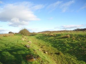
An earthwork marks the site of a Roman fort on the line of the Antonine Wall. The earthwork is located just south of the B816, east of its junction with the A80. Across the A80/M80, in the direction of the village, is the remains of a Roman camp.
Castlecary, Strathclyde, Scotland
Heritage Rating: ![]() ?
?
Nearest Self Catering Cottages
Bar Hill is the highest fort on the Antonine Wall, at 495 feet above sea level, and the site offers excellent views of the Kelvin Valley below. Within the fort are the foundations of a granary, barracks, water tank, street layout, bathhouse and fort headquarters.
Antonine Wall, Twechar, Strathclyde, Scotland
Heritage Rating: ![]() ?
?
Nearest Self Catering Cottages
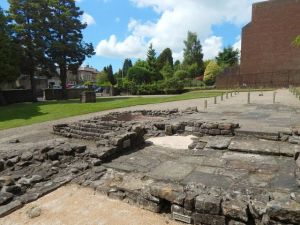
At Bearsden, you can see a 2nd-century bathhouse and an associated latrine built as part of a small fort on the Antonine Wall. Now almost submerged in the urban sprawl of Greater Glasgow, Bearsden Bath House is a reminder of a time when this area was on the furthest edge of the far-flung Roman Empire.
Roman Road, Antonine Wall, Bearsden, Antonine Wall, Strathclyde, Scotland
Heritage Rating: ![]() ?
?
Nearest Self Catering Cottages
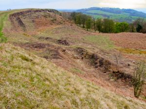
Only an outer ditch and a pair of beacon platforms survive of this Antonine Wall fort atop Croy Hill. The nature of the rocky terrain meant that the Romans were not able to dig a ditch as they normally would, but had to cut through solid rock to create a defensive barrier outside the Wall.
Antonine Wall, Croy, Strathclyde, Scotland
Heritage Rating: ![]() ?
?
Nearest Self Catering Cottages
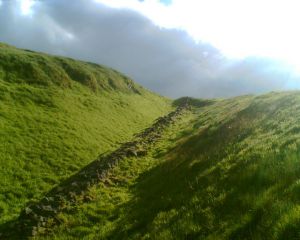
A very well-preserved section of the Antonine Wall ditch survives at Dullatur, just south of the Dullatur Marsh nature reserve. The ditch provided an extra level of defence for the wall, and in places could reach over 20 feet wide.
Antonine Wall, Dullatur, Strathclyde, Scotland
Heritage Rating: ![]() ?
?
Nearest Self Catering Cottages