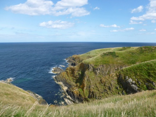
Crathie Point Promontory Fort
The coastal promontory of Crathie Point, west of Sandsend, shows evidence of a raised bank and ditch, effectively creating a simple enclosure, defended from the landward approach. Outside the ditch are faint remnants of a palisade trench.
There are no apparent interior features to the fort, so it is hard to get a clear idea of when or how it was used.
An earthen rampart runs across the headland, with a ditch on either side. The bank is roughly 6m wide and 1.5m high, while both ditches are about 3m wide. A causeway about 5m wide leads through the rampart and ditches near the eastern end.
It seems likely that there was another ditch on the south side of the rampart that has filled up due to ploughing.
If you follow the coast about a mile further to the west you will come to Findlater Castle, a ruinous medieval fortress set in a landscape that suggests an earlier fort, possibly associated with the fort at Crathie Point.
 We've 'tagged' this attraction information to help you find related historic attractions and learn more about major time periods mentioned.