We do not know for sure when Old Kinord was settled, but the most likely dates range from the first millennium BCE to the end of the first millennium AD. There are hut circles at both New Kinord and Old Kinord, and extensive field systems and trackways.
The most obvious remains are the hut circles, composed of low stone wall enclosures in a round shape. Some have sunken interiors. There are souterrains (underground storage chambers) attached to some of the hut circles. There are low stone banks delineating field boundaries and spoil heaps of small stones. Stone dykes show where several ancient trackways ran.
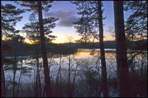
The entire landscape in the Dinnet area is scattered with fascinating prehistoric and early historic sites. An early Christian cross stands on the north shore of Loch Kinord, only a short walk from the settlement site. In the middle of the loch, the smallest island you can see is actually a crannog, a manmade Iron Age island that is one of the very few in the north of Scotland.
A short walk to the north, across the Monandavan Burn, brings you to a medieval moated site (marked 'Homestead Moat' on OS maps. It's a good idea to bring an OS map (Landranger 37), because the hut circles at Old and New Kinord, and the cross slab, may take some finding.
 We've 'tagged' this attraction information to help you find related historic attractions and learn more about major time periods mentioned.