Hindwell is a Roman auxiliary fort, roughly 160m by 143m, with defensive ditches on 3 sides. The fort was probably built in two phases, as the earthworks show two slightly different alignments. The fort was probably erected around AD 55 and was in use until shortly after AD 80.
The Romans chose a site that had been in use over 3000 years earlier. Hindwell Enclosure was erected in the late Neolithic period, with over 14000 oak trees enclosing a site roughly 34 hectares in size. The Roman fort was built over the eastern end of the enclosure.
More Detail
In 1956 finds of pottery at Hindwell Farm suggested the possibility of a Roman presence here. Aerial reconnaissance in 1973 confirmed a Roman fort, visible from the air by a system of low earthwork defences.
The earthworks were surveyed in 1992, revealing a fort and nearby civilian settlement, or vicus, of unknown size. The fort is defended by an irregular ditch fronting a pair of narrower ditches and a rampart. About 120 metres south of the fort the presence of hypocaust bricks and tiles reveal the site of a bathhouse.
To confuse the architectural story still further, pottery finds inside the fort suggest a date around AD 80, while other finds include a piece of pottery stamped PASSIENVS, a potter known to have been working from AD 55-65, suggesting that the site was built much earlier.
Immediately west of the fort lie remains of at least one, and possibly two smaller marching camps, suggesting that the site was used and reused several times.
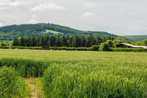
Excavations in 2011 revealed a section of Roman road heading at an angle south-south-west of the fort. The road is roughly 6.5 metres wide plus flanking ditches, and shows no signs of metalling.
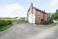
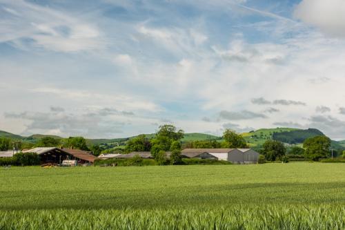
Hindwell Farm is located on the B4357 to Evenjobb, just off the A44. Hindwell Farm is private property, so please ask nicely before exploring the earthworks! If there's no-one to ask, you can still get a fairly good view of the fort layout from the road.
As you look across the farm field from the north-west the fort earthworks are clearly visible in front of and to the left of the farm buildings. Be aware that there are no signposts, so a good OS map will be very useful in helping to find the fort and farm location.
About Hindwell Roman Fort
Address: Walton, Radnor Valley, Powys, Wales
Attraction Type: Roman Site
Location: On the B4357 at Hindwell Farm
Location map
OS: SO257605
Photo Credit: David Ross and Britain Express
HERITAGE
 We've 'tagged' this attraction information to help you find related historic attractions
and learn more about major time periods mentioned.
We've 'tagged' this attraction information to help you find related historic attractions
and learn more about major time periods mentioned.
Historic Time Periods:
Find other attractions tagged with:
1st century (Time Period) - Neolithic (Architecture) - Roman (Time Period)
NEARBY HISTORIC ATTRACTIONS
Heritage Rated from 1- 5 (low to exceptional) on historic interest
Four Stones - 0.8 miles (Prehistoric Site) 
Old Radnor, St Stephen Church - 1.1 miles (Historic Church) 
Discoed, St Michael's Church and Yew Tree - 2.8 miles (Historic Church)
Hergest Croft Gardens - 3 miles (Garden)
Kington, St Mary Church - 3.2 miles (Historic Church)
Presteigne Castle (The Warden) - 4 miles (Castle)
Presteigne, St Andrew's Church - 4.2 miles (Historic Church)
Judge's Lodging - 4.2 miles (Historic Building)
Nearest Holiday Cottages to Hindwell Roman Fort: