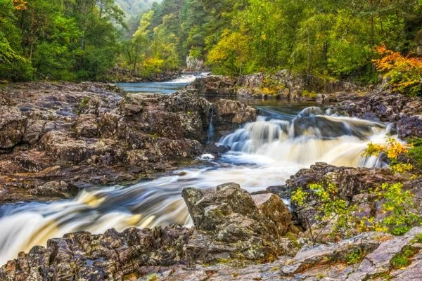
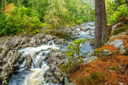
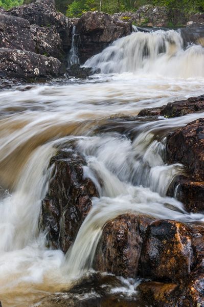
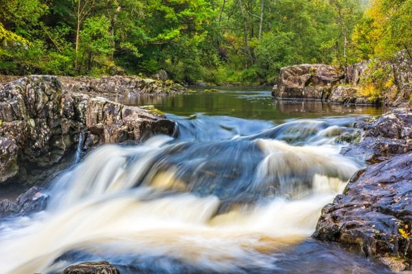
Linn of Tummel is a beautiful area of Perthshire woodland surrounding the junction of the Rivers Tummel and Garry next to the Killiecrankie estate. Walk through pleasant mixed woodland to waterfalls where the swift-flowing Tummel tumbles down to join the Garry near Pitlochry.
Linn comes from the Gaelic word 'linne', meaning a pool.
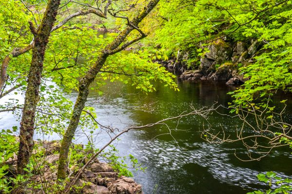
The National Trust for Scotland maintains 56 acres of woodland, with a circular walk passing through lovely scenery as it follows the course of the River Garry to its junction with the Tummel. At the junction of the rivers is an old fish-pass, built in 1910 for fish to traverse a series of waterfalls on the River Tummel.
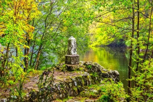
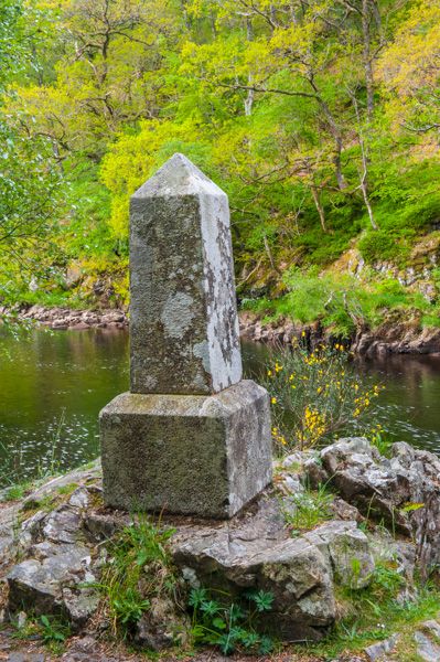
On a small promontory jutting out into the river is a memorial obelisk commemorating the visit here by Queen Victoria in 1844. The inscription on the base of the obelisk reads simply, 'Victoria R, Sep 17 MDCCCXLIV'.
A 20-minute walk up the River Tummel from the memorial brings you to a small suspension bridge known as the Coronation Bridge.
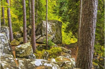
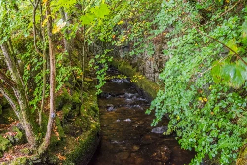
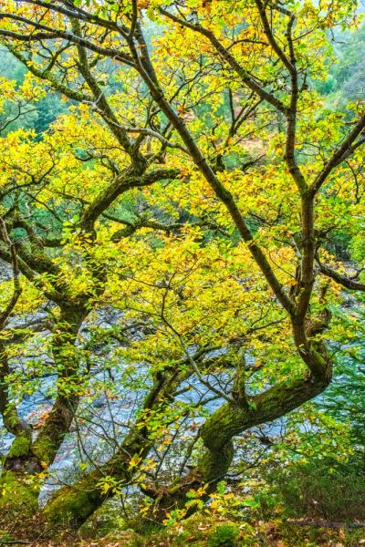
The walk passes through oak woods where spring flowers bloom under the forest canopy. There are nesting boxes for goosanders to encourage them to settle beside the river. The woodland is probably at its best in autumn, when the trees are a riot of rich colours.
The best place to access the Linn of Tummel is from the council car park at Garry Bridge (OS: NN912609) on the B8019, at the south end of the Pass of Killiecrankie. From the bridge, you can get excellent views of Killiecrankie, but the trail to the Tummel Falls passes underneath the bridge and follows the course of the river south for less than a mile to the junction of the rivers.
You can explore the waterfalls and then either retrace your steps or follow the trail in a loop that takes you to Coronation Bridge, then brings you back to the B8019. An OS map is useful but not essential, especially if you opt to simply walk to the falls and return by the same riverside route.
You can also take a longer walk linking the Linn of Tummel to the National Trust for Scotland's estate at Killiecrankie, where there is a visitor centre exploring the history of the Pass and the 1689 Battle of Killiecrankie. We took this longer walk, starting at the Killiecrankie visitor centre and walking along the River Garry, over a suspension bridge, then along the riverside to Garry Bridge where we joined the Linn of Tummel path.
Again, the way is very well signposted and you do not need an OS map, though it is always handy to have one with you. The riverside is simply stunning, and well worth exploring, especially in the autumn when colours start to turn.
From the Garry car park to the Falls of Linn takes about 20 minutes (roughly 1 mile). From the Falls to Coronation Bridge is another 20 minutes (1 mile). So if you walk from the car park to the Falls, then on to the bridge, and return the same way that's a total of 4 miles, or roughly 80-90 minutes.
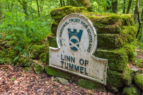
One point to note is that there is no information panel at Linn of Tummel. That's a shame as it would really help, especially to explain the Edwardian fish pass, which isn't easy to interpret without some sort of historical context. There is, however, an information panel at Garry car park, giving a brief overview of the site and a useful map.
More Photos

About Linn of Tummel
Address: Pitlochry, Perthshire, Scotland, PH16 5NP
Attraction Type: Countryside
Location: On the B8019, 2.5 m (4 km) NW Pitlochry
Website: Linn of Tummel
National Trust for Scotland
Location
map
OS: NN903 611
Photo Credit: David Ross and Britain Express
Opening Details: Open access site, usually accessible at any reasonable time
HERITAGE
 We've 'tagged' this attraction information to help you find related historic attractions and learn more about major time periods mentioned.
Find other attractions tagged with:
Edwardian (Historical Reference) - Queen Victoria (Person)
NEARBY HISTORIC ATTRACTIONS
Heritage Rated from 1- 5 (low to exceptional) on historic interest
Killiecrankie - 1.3 miles (Countryside) ![]()
Craigower - 1.5 miles (Countryside) ![]()
Tay Forest Park - 2.2 miles (Countryside) ![]()
Queen's View - 2.6 miles (Countryside) ![]()
Sunnybrae Cottage - 2.7 miles (Historic Building) ![]()
Pitlochry & Moulin Heritage Centre - 2.8 miles (Museum) ![]()
Pitlochry Dam & Fish Ladder - 2.9 miles (Historic Building) ![]()
Black Castle (Caisteal Dubh) - 3.1 miles (Castle) ![]()
Nearest Holiday Cottages to Linn of Tummel:
Blair Atholl, Tayside
Sleeps: 8
Stay from: £601 - £4,120
More self catering near Linn of Tummel