I thought of calling this article 'The Most Beautiful Waterfalls in Scotland', but I don't know how I would ever decide which was more beautiful than the others!
As an avid photographer, I'm drawn to the beauty of the Scottish countryside again and again. Over the past few decades exploring Scotland, I must have photographed 100 waterfalls, both famous and unknown. These are some of my favourites.
I've added instructions on how to reach each waterfall, along with Ordnance Survey Grid References. Some of these waterfalls can only be viewed after a long walk, but others are more easily accessible by car. One of the most spectacular is just a few steps from a car park.
I could have organised this list from 22 to 1 (or the other way around), but I couldn't decide which waterfall to rank as number one, so I'm simply going to do it alphabetically!
Fort Augustus, Loch Ness, Highlands, PH32 4BL
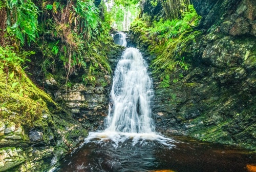
Just outside Fort Augustus above the shores of Loch Ness is Allt na Criche waterfall, reached by an easy trail following beside All na Criche burn. Head north on the A82 from Fort Augustus in the direction of Inverness and you will see a Forestry Commission Scotland car park signposted on your left after about one mile (1.6km). From the car park just follow the well-signposted trail towards the waterfall.
Access: Easy
OS: NH390108
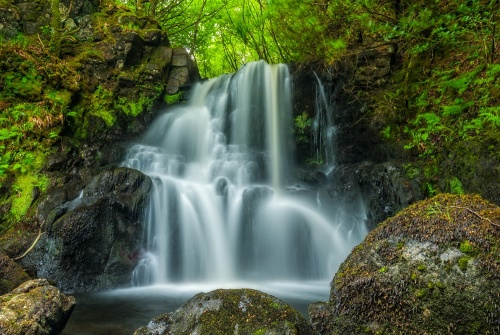
Aros Park, Tobermory, Isle of Mull, Argyll
This lovely cascade is one of two falls in Aros Park, on the edge of Tobermory, Isle of Mull. You can walk from Tobermory, following the Coastal Trail behind the Harbour Building, or take the A848 south from the town for 1.2km. The park postcode is PA75 6AD. Within the park, simply follow the signposted Waterfalls Trail along the Aros Burn.
Access: Very Easy
OS: NM516535
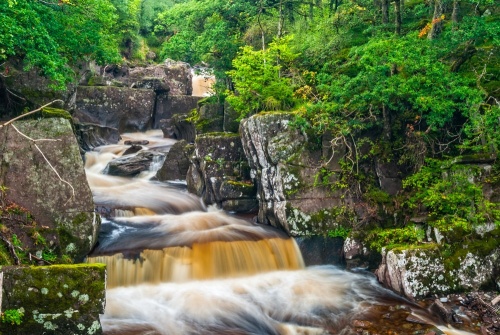
Callander, Stirling, FK17 8EU
A signposted trail leads from Bracklinn Falls car park on Bracklinn Road in Callander to this popular beauty spot, which has drawn visitors since the Victorian period. The trail passes through pleasant woodland until it arrives at Keltie Water where you get outstanding views of the falls. You can cross the burn via Bracklinn Bridge, which passes directly above the waterfall.
Access: Easy
OS: NN645085
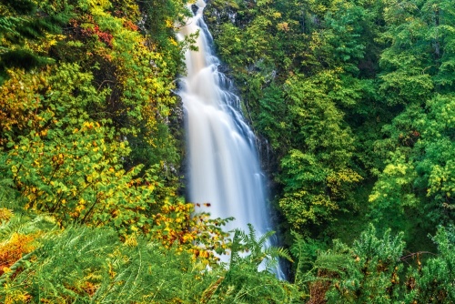
nr Divach Lodge, Drumnadrochit, Loch Ness, Highlands, IV63 6XW
At Divach Falls, near Drumnadrochit, the Divach Burn spills over a cliff and falls 100 feet (30m) to a pool below. The falls are reached by footpath through pleasant oak woodlands. The waterfall is at its best after heavy rains.
Turn off the A82 at Lewiston, on the southern edge of Drumnadrochit, onto Balmacaan Road, signposted to Balmacaan and Divach. After half a mile take the right fork at a junction and continue on for another half mile as the road begins to climb towards Clunemore Steadings. Look for a Forestry Commission parking area to the right of the road.
From the parking area, a clearly signposted trail leads through oak woodland to the viewing platform. It is roughly 300m to the viewing platform and a round trip from the parking area is about 30 minutes.
Access: Easy
OS: NH494274
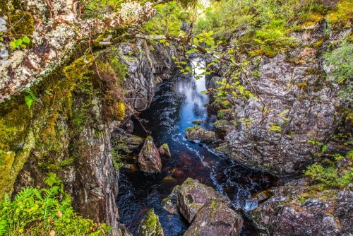
Glen Affric, Cannich, Highlands
Glen Affric is a secluded Highland glen stretching southwest of Cannich. The most popular - and easiest to access - point for visitors to Glen Affric is Dog Falls, the first parking area you come to as you travel west down the glen from Cannich. There are three signposted trails from the parking area, one of which leads for 3.2km (2m) to a viewpoint overlooking Dog Falls, where the River Affric plunges down a steep-sided gorge.
Access: Easy
OS: NH283282
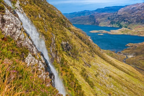
Unapool, Sutherland
This is one of the hardest waterfalls on the list to get to, but also one of the most spectacular. Eas a Chual Aluinn is the highest fall of water in Britain at 638 feet. The falls spill from a high plateau overlooking Loch Glencoul and fall 200 metres in two steps to the shore of the loch.
Park at the hairpin bend on the A894 by Loch na Gainmhich. The nearest postcode for the parking area is IV27 4HW. You will need OS Explorer 442, covering Assynt.
A round trip is 6 miles and will take 4-5 hours. If you don't fancy the exercise, you can see the waterfall by taking one of the tour boats from Kylesku.
A visit to Eas a Chual Aluinn can be combined with a very short side trip to Wailing Widow Falls (below), a stone's throw from the parking area on the A894.
Access: Challenging
OS: NC280277
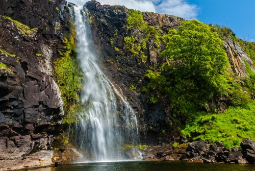
Ulva Ferry, Isle of Mull, Argyll, PA73 6LT
Outdoing the Falls of Bruar (below), which has two waterfalls, Eas For has three, Upper, Middle, and Lower. The waterfalls are located close to the coastal road and are very easy to reach, but be careful! The Lower Falls spill over a sheer cliff to crash down onto the rocks 30m below, and there is no fence or other safety barrier.
The Lower Falls are not recommended if you have young children. However, if you go south down the road in the direction of the ferry there is a track down the stony beach, and you can make your way back up the beach to the base of the waterfall.
The words 'Eas For Waterfall' form a tautology, in that each word means the same thing. Eas is the Gaelic word for waterfall, while Fors is Norse for waterfall, so the three words combined simply mean Waterfall Waterfall Waterfall!!
Off the B8073, 2 miles north of Ulva Ferry.
Access: Upper and Middle Falls: Easy, Lower Falls: Challenging
OS: NM445423
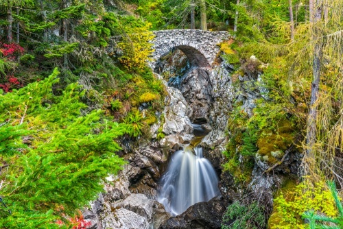
House of Bruar, B847, Blair Atholl, Perthshire, PH18 5TW
There are not one but two waterfalls at Bruar, near Blair Atholl. This is one of several sites linked to Robert Burns, who came here in 1787 and later wrote an impassioned appeal to the Duke of Atholl to plant trees on both sides of Bruar Water to create the idyllic setting we see today. Park at the House of Bruar, at the junction of the A9 with the B847/B8079 just west of Blair Atholl.
From the parking area follow the signposted path along Bruar Water to the Lower Falls, then cross the [picturesque bridge to the far bank and walk through woodlands to a viewpoint of the spectacular Upper Falls].
Access: Lower Falls: Easy, Upper Falls: Moderate
OS: NN821659
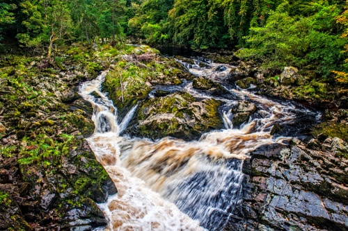
Banchory, Aberdeenshire, AB31 6NH
The River Feugh joins the River Dee just outside Banchory. Immediately south of the confluence of the two rivers are the Falls of Feugh. This is an excellent place to watch the annual salmon run. You can view the waterfall from a footbridge across the river. There is a parking area on the B974 on the far side of the bridge, or you can walk from the centre of Banchory, roughly 1km away.
Access: Easy
OS: NO701949
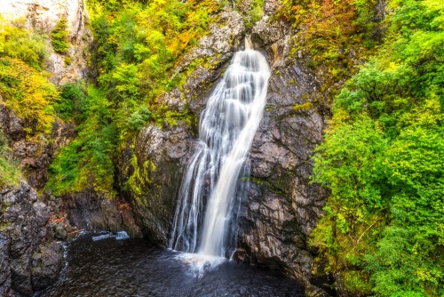
B862, Foyers, Loch Ness, Highlands
Another Scottish waterfall commemorated in a poem by Rober Burns, this dramatic waterfall is reached by a lovely walk through woodland, made glorious in autumn when the colours are at their best.
Foyers is on the quieter south-east side of Loch Ness, reached by the B862 from Fort Augustus. There is a parking area beside the village shop and a well-signposted trail opposite. The nearest postcode is IV2 6XX.
Access: Moderate
OS: NH497203
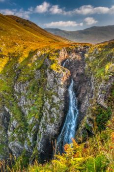
North east of the A87 and east of Kyle of Lochalsh; best reached from Dorusduain car park, 2.5 m (4 km) off the northern section of the loop in the old A87 at the National Trust for Scotland countryside centre.
The Falls of Glomach is among of the highest waterfalls in Britain at 113m (370 feet). The Falls are set in a narrow cleft in the remote countryside above Morvich.
To reach the waterfall requires a 10-11 mile walk taking 5 hours. If you come in autumn you can hear the bellows of stags bellowing challenges to each other from the surrounding hills. Do not attempt this walk without an Ordnance survey map!
Access: Challenging
OS: NH019256
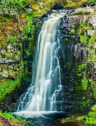
The most beautiful waterfall on the Isle of Arran, Glenashdale is actually two separate waterfalls, Upper and Lower, with a combined drop of 45m (140 feet). There are viewing platforms for each waterfall projecting out over Glenashdale Burn.
A trail leads from a parking area on the A841 coast road at the southern end of Whiting Bay, immediately south of Ashdale Bridge, and proceeds beside the burn through beautiful woodland. The car park grid reference is NS045255. Simply follow the signposted trail along the burn. The route can be extended to create a circular walk that also visits the Giants' Graves Neolithic chambered tomb.
Access: Easy
OS: NS029249
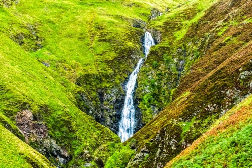
Moffat, Dumfries and Galloway, DG10 9LH
The Grey Mare's Tail is the 5th-highest waterfall in Britain, a spectacular 60m (200-foot) waterfall, tumbling down the deep gorge of Tail Burn from Loch Skeen to the valley of Moffat Water far below.
The waterfall is just part of a National Trust for Scotland nature reserve, offering fabulous upland scenery and walking opportunities. The parking area is pay and display, but is free for National Trust for Scotland members. In summer there are guided tours of the nature reserve.
Adjacent to the A708, 10 miles northeast of Moffat.
Access: Moderate to Challenging, depending on how far you want to climb
OS: NT086 053
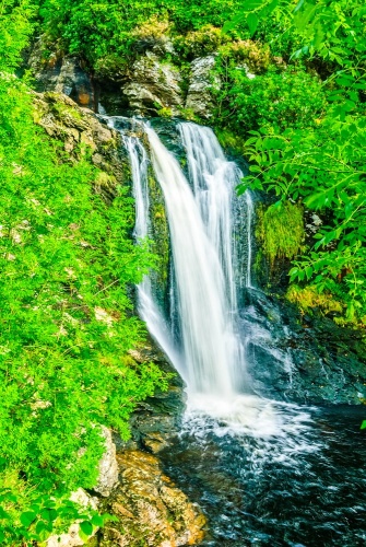
Inversnaid Hotel, Loch Lomond, Stirling, FK8 3TU
The long, winding road that runs west from Aberfoyle finally comes to an end at the hamlet of Inversnaid, on the east bank of Loch Lomond, where the West Highland Way runs along the loch. There is little at Inversnaid beyond a hotel, but a path leads from the hotel grounds to a viewing area overlooking Inversnaid Falls, a small but picture-perfect falls on Arklet Water. The RSPB operates a nature trail, which also starts at the Inversnaid Hotel.
Access: Very Easy
OS: NN337090
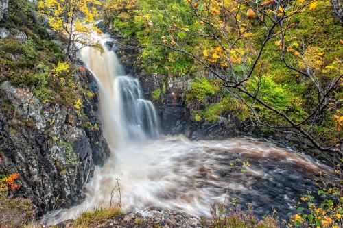
The Falls of Kirkaig is a wonderfully scenic waterfall on the River Kirkaig, south of Lochinver, on the main approach route to Suilven. The walk to the Falls can be combined with a longer walk and ascent of Suilven.
The walk to the falls is just over two miles each way and follows the route of the river Kirkaig through woodlands before emerging into open moorlands. Count on three hours there and back. Use the OS Explorer map 442 Assynt.
Be careful near the falls! There is no railing and it would be easy to take a very nasty fall on the wet rocks.
Free parking at the end of the road at Inverkirkaig, south of Lochinver. The nearest postcode is IV27 4LR.
Access: Moderate to Challenging
OS: NC111178
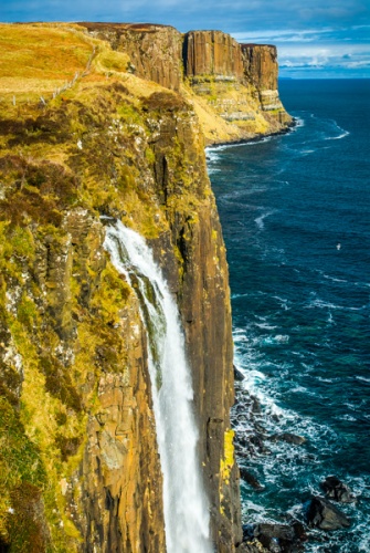
Staffin, Trotternish Peninsula, Isle of Skye, IV51 9JE
The outflow from the small inland loch of Loch Mealt spills over a sheer basalt cliff and drops 90m (300 feet) to the rocks below.
The dramatic cliffs at Mealt are rippled like a pleated kilt, giving them the popular name Kilt Rock. There is a viewpoint and free parking area at the end of a lane accessed off the A855, 2km south of Staffin, at the north end of Loch Mealt.
Access: Very Easy
OS: NG508655
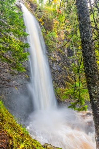
Tomich, Glen Affric, Highlands, IV4 7LY
Plodda Falls is a dramatic waterfall on the Abhainn Deabhag, a tributary of the River Affric. The falls are deep in glorious fir woodland on the south side of Glen Affric.
The main falls plunge 151 feet (46m) almost straight down from a rocky outcrop to the river far below. A viewing platform juts out over the top of the falls so that visitors can look almost straight down from the top of the plume.
The waterfall is set in a glorious late Victorian Douglas fir plantation that was once part of Lord Tweedmouth's Guisachan estate. The area around Plodda is full of Douglas firs that make the forest an extraordinary experience to explore. Colour-coded circular trails lead through woodland. The Plodda Falls Trail is 1.6km (1 mile) long and will take roughly 30 minutes for a return trip.
On a dirt road signposted from Tomich village in Glen Affric. Paid parking.
Access: Moderate
OS: NH280238
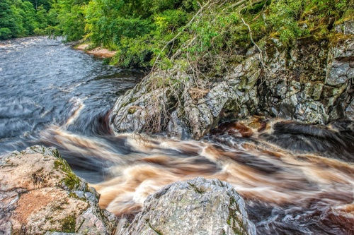
Logie, Moray
I'm going to bend the rules of this list and include Randolph's Leap, which isn't a waterfall so much as a scenic and historic beauty spot on the River Findhorn where the water rushes over a cascade between two jagged fingers of rock. The 'Leap' gets its name from a famous incident in the 14th century when four men leapt across the chasm to avoid capture by their enemies.
To reach Randolph's Leap you have two choices. The simplest is to park at a layby on the B9007, just south of the Bridge of Logie and 7 miles south of Forres. From here a very short path leads down to the Leap. An alternative is to park at Logie Steading visitor centre, off the B9007.
From the Steading, take the signposted footpath, which leads along the river, crosses the bridge, and then follows the trail to the Leap. The entire round trip from Logie Steading is about two miles.
Access: Easy
OS: NH999495
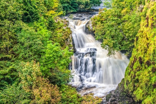
B954, Bridge of Craigisla, Angus, PH11 8HW
Reekie Linn is one of the easiest waterfalls to access in all of Scotland. There are two linked falls on the River Isla, at Bridge of Craigisla, about 4 miles north of Alyth, Angus. There is a parking area immediately north of the bridge on the B954, with picnic tables and an information sign explaining the geology of the area and the variety of birdlife you can see there.
From the parking area, there is a short 5-minute walk to a viewing area for the falls. The two falls have drops of 6 metres and 18 metres, but when the River Isla is in spate the two falls merge to create a single drop of 24 metres.
Access: Very Easy
OS: NO254537
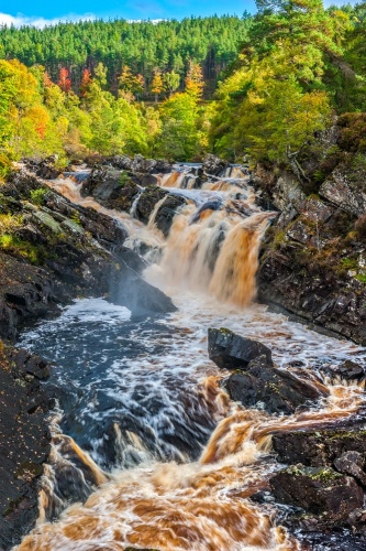
A835, Contin, Highlands
A picturesque suspension bridge across Black Water provides an exceptional view of a striking waterfall that is also one of the best places in Scotland to watch the annual salmon run (best in August and September). There is a public car park off the A835 about two miles west of Contin at grid reference NH442585.
From Inverness, take the A835 towards Ullapool. There are public toilets, (summer months only). The nearest postcode for satnavs is IV14 9EQ, which is about 1 mile east of the car park (towards Inverness).
Access: Moderate
OS: NH443585
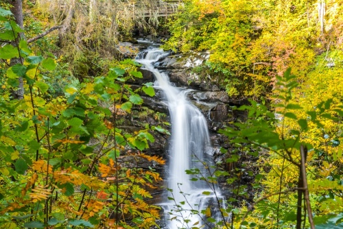
Crieff Road, Moness, Aberfeldy, Perthshire, PH15 2BJ
The Birks of Aberfeldy is a woodland area on the edge of Aberfeldy in Perthshire. The Birks (from a Gaelic word for birch trees) was made famous in a poem by Robert Burns.
A trail leads beside Moness Burn, following in the poet's footsteps, to the Upper Falls of Moness, where the water drops 380m in three distinct steps.
Access: Moderate
OS: NN855486
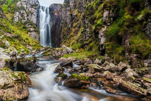
4km (2.4 miles) south of Unapool, Sutherland
This utterly spectacular waterfall spills from the northern end of Loch na Gainmhich, just south of Unapool. This is one of the easiest waterfalls in Scotland to visit, located 300 yards from a car park at the hairpin bend on the A894 beside Loch na Gainmhich. The car park is at NC240292 (the nearest postcode is IV27 4HW).
The water spills almost straight down from the outflow of the loch, falling 30m (100 feet) to the burn below. You can get good views from above the waterfall, but for the best effect follow the gorge until you see a rough path leading down to the burn, then follow it back to the base of the falls.
Access: Easy to Moderate, depending on whether you descend into the gorge or not
OS: NC242293
MOST POPULAR POSTS
