There are two castles here, built along a high, narrow ridge overlooking a loop in the River Ithon. The name translates loosely as 'ridge court'. It is possible that the first earthwork defences at Cefnllys were erected by Elystan Glodrydd in the 10th century, but the most commonly accepted version of events is that the powerful Norman lord Roger Mortimer began the first stone fortifications around 1240.
It is possible that Mortimer's castle bailey was formed by the much earlier ramparts of an Iron Age hillfort.
History
Mortimer's castle was badly damaged in 1262 and as a result his family erected a second castle was to the south-west, beginning about 1273.
This second castle was badly damaged in Owain Glyndwr's revolt around 1406. The defences were repaired, and a house for the castle constable was built around 1432. By 1540 the chronicler John Leland recorded the castle as being in ruins and today there is little left of Mortimer's fortress.
The larger second fortress was composed of a round tower within a walled court, about 35 metres square. There were further round towers at the north and east corners, where the entrance probably stood.
At the base of the hill was a settlement, occupying a riverside terrace of land. We do not now when the town was founded, but it was granted a market charter in 1297. The settlement became a borough, but its prosperity seems to have been short-lived. Despite that fact, Cefnllys was one of 5 Radnorshire boroughs that jointly elected an MP under the 1536 Act of Union.
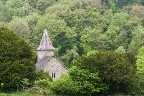
Nothing remains of the settlement beyond the isolated medieval church, dedicated to St Michael and known in Welsh as Llanfihangel Cefnllys.
Visiting
This is where it gets a bit tricky. There are no signs to the castle, and as the saying goes, if you didn't know it was there you wouldn't know it was there. Here's how to find the caste site.
From the centre of Llandrindod Wells follow Spa Road East. The road turns into Cefnllys Lane as it leaves the town. Follow the lane until you reach a picnic area at Shaky Bridge, on the east bank of the River Ithon. There is a free parking area with several picnic tables beside the river. Cross the bridge and you can see a well-trodden path to St Michael's church to the left.
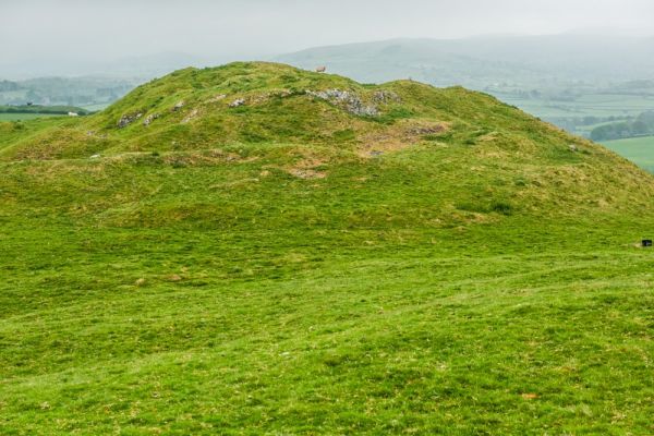
Ahead is the ridge of Castle Bank. There are no good trails to the top, and if the bracken is high you will have a bit of a slog getting up the hill, but there is no way to get lost; just keeping climbing until you reach the nearest, very obvious summit. It should take about 15 minutes to reach the top.
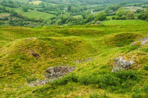
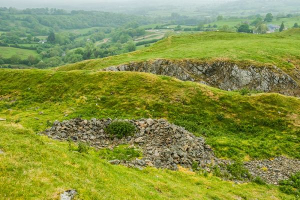
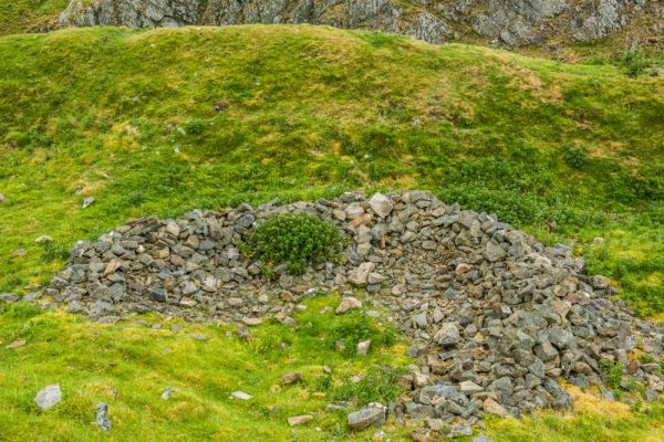
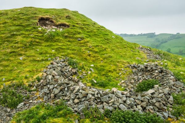
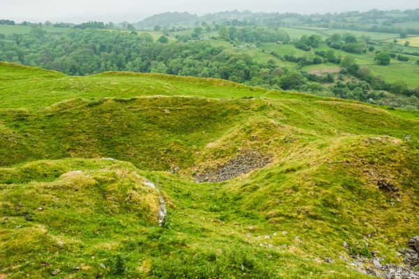
This is Castle Hill, the second, smaller fortification erected by the Mortimers. The most impressive bit of this castle is a rock-cut ditch, creating a formidable barrier and isolating the summit from the ridge. Around the summit you can see signs of quarrying and definite defensive earthworks.
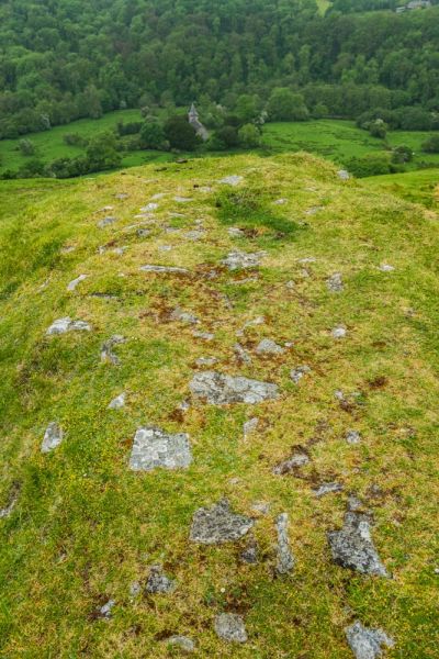
Look north-east to the larger and more impressive first castle, defended by deep ditches and banks. You can clearly see rectangular earthwork enclosures, but there is very little evidence of obvious stonework.
The views from the castle are wonderful, and make the climb well worth it, even if the tangible castle remains are relatively sparse.
More Photos

About Cefnllys Castle
Address: Llandrindod Wells, Powys, Wales
Attraction Type: Castle
Location: 2 miles east of Llandrindod Wells, off minor roads
Location map
OS: SO089614
Photo Credit: David Ross and Britain Express
Opening Details: Open access site, usually accessible at any reasonable time
HERITAGE
 We've 'tagged' this attraction information to help you find related historic attractions
and learn more about major time periods mentioned.
We've 'tagged' this attraction information to help you find related historic attractions
and learn more about major time periods mentioned.
Historic Time Periods:
Find other attractions tagged with:
10th century (Time Period) - 16th century (Time Period) - castle (Architecture) - castle (Architecture) - Iron Age (Architecture) - Medieval (Time Period) - Norman (Architecture) - Owain Glyndwr (Person) - Roger Mortimer (Person) - round tower (Architecture)
NEARBY HISTORIC ATTRACTIONS
Heritage Rated from 1- 5 (low to exceptional) on historic interest
Llanfihangel Cefnllys Church - 0.2 miles (Historic Church) ![]()
Radnorshire Museum - 1.8 miles (Museum) ![]()
National Cycle Collection - 1.8 miles (Museum) ![]()
Llandrindod Wells, Holy Trinity Church - 1.9 miles (Historic Church) ![]()
Rock Park - 2.1 miles (Garden) ![]()
Castell Collen Roman Fort - 2.2 miles (Roman Site) ![]()
Castell Crug Eryr - 4.5 miles (Castle) ![]()
Cregrina, St David Church - 6.2 miles (Historic Church) ![]()
Nearest Holiday Cottages to Cefnllys Castle :