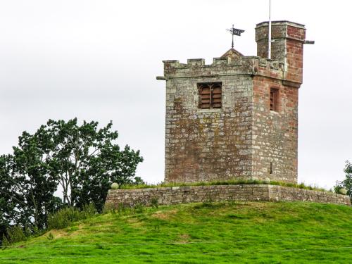
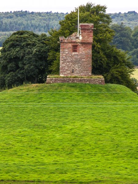
Kirkoswald is a small village known for its ruined castle. The ruins are now overgrown, but the traces of the moat are clearly visible, and one crumbling tower still stands. The small, two-aisled 12th-century church is unusual in that it has a detached bell tower situated 200 feet away on the top of a hill overlooking the village.
The tower may have been built in such an odd position in order to better warn villagers of approaching Scottish raiders. The tower is a very obvious landmark, easily visible from nearby roads. So easily visible that I came around a corner of the road, spied the tower, and immediately pulled off the road to photograph it.
St Oswald's Well is built into the wall of the church, and it is thought that the source of the well is a stream running under the nave of the church. In the village is The College, a reminder that St Oswald's church was once a collegiate church, with a college of priests established by the Dacre family, lords of the manor.
The College was built in 1450 as a pele, or fortified tower. After the college of priests was dissolved in the Reformation the tower became a residence for the Fetherstonehaugh family.
The village is named for Oswald, King of Northumbria, whose body is thought to have been taken through the village en route to burial. It gained a market charter in the 13th century, but unlike many market settlements, it never developed into a town. There are 2 pubs on the Market Place; the Fetherston Arms and the Crown Inn.
Kirkoswald Castle
This small castle was built around 1210 but was ruinous a century later. The fortifications were rebuilt in the 15th century when a moat and wall were added. When the Dacre family joined the Rising of the North their possessions, including the castle, were forfeited to the crown. The castle was later granted to Lord William Howard but allowed to fall into decay by the early 17th century.
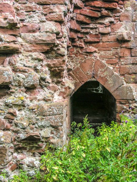
Stone from Kirkoswald was used to build Naworth Castle, leaving only a single tower. That tower, however, is impressive enough to give some idea of how imposing the castle would have looked for it stands 60 feet high and features finely carved doorway openings.
You can easily make out the earthworks and moat that still encircle the castle. The castle tower stands almost hidden by a stand of trees, to the south east of the village, off the minor road to Busk.
More Photos

About Kirkoswald
Address: Kirkoswald, Cumbria, England
Attraction Type: Town
Location: 3 miles north of Great Salkeld on the B6413
Location map
OS: NY555413
Photo Credit: David Ross and Britain Express
HERITAGE
 We've 'tagged' this attraction information to help you find related historic attractions
and learn more about major time periods mentioned.
We've 'tagged' this attraction information to help you find related historic attractions
and learn more about major time periods mentioned.
Find other attractions tagged with:
12th century (Time Period) - 13th century (Time Period) - 15th century (Time Period) - 17th century (Time Period) - 5th century (Time Period) - 7th century (Time Period) - castle (Architecture) - collegiate church (Historical Reference) - moat (Historical Reference) - Reformation (Historical Reference) - St Oswald (Person)
NEARBY HISTORIC ATTRACTIONS
Heritage Rated from 1- 5 (low to exceptional) on historic interest
Little Meg Cairn - 2.7 miles (Prehistoric Site) 
Long Meg and Her Daughters - 2.8 miles (Prehistoric Site)
Hutton-in-the-Forest - 6.8 miles (Historic House) 
Brougham, St Ninian Ninekirks - 7.1 miles (Historic Church)
Penrith, St Andrew's Church - 7.2 miles (Historic Church)
Penrith Castle - 7.6 miles (Castle)
Brougham Castle - 7.7 miles (Castle)
The Countess Pillar - 7.7 miles (Historic Building)
Nearest Holiday Cottages to Kirkoswald: