Rhayader Castle was built in 1177 by Rhys ab Gruffudd, better known as Lord Rhys, the Prince of the Welsh kingdom of Deheubarth.
History
Lord Rhys built the castle to counter the threat of Norman incursions into Wales along the River Wye. He had good reason to be wary of the Normans, particularly the ambitious Roger de Mortimer, Earl of Wigmore, who was keen to extend his territory deeper westward into what is now Wales.
Just the year before, in 1176, the Welsh princes Einion Clyd (Lord Rhys' son-in-law) and Morgan ap Meredydd had been returning from a Great Eisteddfod hosted by Lord Rhys to celebrate the completion of his new fortress of Cardigan Castle when they were ambushed and killed by Mortimer's men. The ambush is said to have taken place at Maen Serth (the Prince's Stone) just two miles from Rhayader.
Lord Rhys quite rightly feared that Mortimer would keep pushing west along the River Wye, so he hurriedly built a fortress on a rocky outcrop overlooking the river.
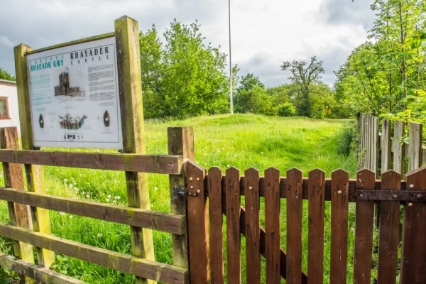
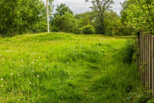
The castle was a simple timber fortification surrounded by a dry moat, using the steep cliffs for further defence on the side facing the river. Today the most obvious remnant of the castle is a section of the moat, cut through rock to form a ditch known locally as The Moat, visible at the entrance to Waun Capel Parc. The ditch is roughly 10m wide and 4m deep.
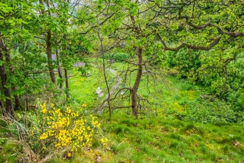
Inside the park is a level area known as The Castle, which was probably where the keep and a lookout point stood. The level area is roughly rectangular and measures 50m x 40m on a north-east to south-west axis. The main entrance was probably on the north side. To the south stood the castle mill.
Rhayader was on the eastern fringes of Lord Rhys' territory and to the east lay the kingdom of Maelienydd. The castle must have been seen as an act of aggression, for in 1190 the sons of Cadwallon ap Madog of Maelienydd attacked and destroyed it, capturing Lord Rhys in the process. In 1192 the English captured the castle but almost immediately it was retaken by Lord Rhys, who rebuilt it in 1194 only to have it destroyed once more by the English.
By 1200 the powerful Mortimer family had successfully taken control. They either rebuilt the previous castle or began a new one on the same site. The Welsh were back in 1202 and recaptured the castle once more.
Rhayader Castle was the major fortress of the Welsh territory of Gwerthrynion. In 1231 Llywelyn ap Iorwerth of Gwynedd attacked and destroyed the castle and killed the entire garrison. Tradition says that the dead soldiers lie buried near the porch of the nearby parish church.
A document from 1304 refers to it as the 'site of the ancient castle', suggesting that it was no longer in good condition. It was still referred to as a castle in 1316. It may have continued as an administrative centre for the manor but it appears to have been abandoned by the middle of the 14th century.
Alternative History
The above account is the generally accepted version of events, but there is some doubt over the castle's actual location. The confusion arises because there was a second castle motte across the river on the west bank. The west bank was in Lord Rhys' territory while the east bank was in Gwrtheyrnion. Would Lord Rhys have established a castle outside his territory?
While possible, an alternative conclusion is that Lord Rhys' castle was on the west bank, in his own territory, while the fortress we now call Rhayader Castle was built by the Normans on the east bank sometime later, around the turn of the 13th century.
Visiting
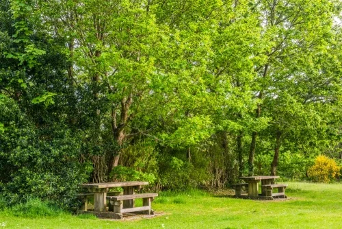
Access is very easy. The castle lies just off Church Street, a very short distance from the medieval parish church of St Clement. There are no signs to the castle, just an information panel at the site entrance, behind a row of cottages.
About Rhayader Castle
Address: Rhayader, Powys, Wales
Attraction Type: Castle
Location: Just off Church Street and Waun Capel Parc, on the east bank of the River Wye.
Location map
OS: SN968680
Photo Credit: David Ross and Britain Express
NEARBY HISTORIC ATTRACTIONS
Heritage Rated from 1- 5 (low to exceptional) on historic interest
Rhayader, St Clement's Church - 0.1 miles (Historic Church) ![]()
Cwmdauddwr, St Bride's Church - 0.2 miles (Historic Church) ![]()
Llanwrthwl, St Gwrthwl's Church - 2.7 miles (Historic Church) ![]()
Nantgwyllt Church - 4.5 miles (Historic Church) ![]()
Abbey Cwm Hir Hall - 5.7 miles (Historic House) ![]()
Cwmhir Abbey - 5.8 miles (Abbey) ![]()
Castell Collen Roman Fort - 6.3 miles (Roman Site) ![]()
Rock Park - 7 miles (Garden) ![]()