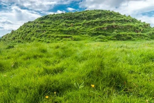
Torr a'Chaisteal is a circular Iron Age fort, or dun, on a ridge near the southwestern tip of Arran. The Dun is constructed with a double-skin wall up to 12 feet wide, enclosing an area 45 feet across. The walls are made with two sets of large blocks of sandstone in-filled with rubble.
Little remains save the foundations of the wall. The entrance on the northeast of the site is protected by a curving earth bank, 20 feet on the exterior slope and 5 feet high inside the fort.
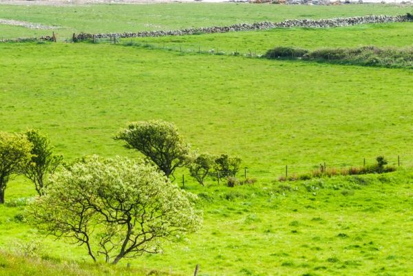
The fort may have been used as an animal enclosure, or perhaps as a defended farmstead, with access to the nearby coast. The most likely date of construction is sometime around AD 200. There are indications of a defensive ditch across the promontory to make the site more secure from attack.
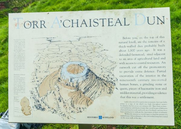
Excavations in the 19th century found human bones within the fort, in addition to a quern stone for grinding grain. The Historic Scotland information board suggests that there may have been a timber house about 14m in diameter within the fort, its roof resting on the stone walls of the dun, though no evidence of such a dwelling can be seen now. Today Torr a'Chaisteal seems a lonely place, with little to show how its residents lived so many years ago.
Torr a'Chaisteal is similar to other sites built around western Scotland during the first and second centuries AD. They seem similar in usage to the Iron Age brochs found further north, and may have been built as a status symbol for a single extended family.
There is another nearby dun at Kilpatrick, near Blackwaterfoot. Compare these duns to the larger fort at Drumadoon (The Doon), which was made to support more people.
Getting There
The dun is now cared for by Historic Environment Scotland (formerly Historic Scotland). It is reached by a 0.5km footpath off the coastal road at Corriecravie, south of Blackwaterfoot. There is an interpretation panel at the foot of the dun, with an artist's impression of what it looked like when it was in use.
More Photos

About Torr a'Chaisteal Dun
Address: Blackwaterfoot, Isle of Arran, Arran, Ayrshire, Scotland
Attraction Type: Prehistoric Site
Location: 4 miles (6km) south of Blackwaterfoot, off the A841
Website: Torr a'Chaisteal Dun
Historic Scotland
Location map
OS: NR921 232
Photo Credit: David Ross and Britain Express
Opening Details: Open access site, usually accessible at any reasonable time
POPULAR POSTS
HERITAGE
 We've 'tagged' this attraction information to help you find related historic attractions
and learn more about major time periods mentioned.
We've 'tagged' this attraction information to help you find related historic attractions
and learn more about major time periods mentioned.
Find other attractions tagged with:
19th century (Time Period) - Iron Age (Architecture)
NEARBY HISTORIC ATTRACTIONS
Heritage Rated from 1- 5 (low to exceptional) on historic interest
Kilpatrick Dun - 2.1 miles (Prehistoric Site) ![]()
Torrylin Cairn - 2.5 miles (Prehistoric Site) ![]()
The Doon Iron Age Hillfort - 4.3 miles (Prehistoric Site) ![]()
Carn Ban - 4.6 miles (Prehistoric Site) ![]()
King's Cave - 5.3 miles (Countryside) ![]()
Machrie Moor Standing Stones - 5.7 miles (Prehistoric Site) ![]()
Moss Farm Road Stone Circle - 6 miles (Prehistoric Site) ![]()
Eas Mor Falls - 6.1 miles (Countryside) ![]()
Nearest Holiday Cottages to Torr a'Chaisteal Dun:
Nearby accommodation is calculated 'as the crow flies' from Torr a'Chaisteal Dun. 'Nearest' may involve a long drive up and down glens or, if you are near the coast, may include a ferry ride! Please check the property map to make sure the location is right for you.

Brodick, Strathclyde
Sleeps: 14
Stay from:£1,631 - £4,649