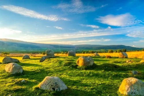
Beside the trail that leads to the famous standing stones on Machrie Moor is an attractive little Bronze Age ring cairn surrounded by a circle of standing stones. Though it is called a stone circle, it is, in fact, a burial mound, surrounded by upright kerb stones.
The Moss Farm site (sometimes known as Machrie Moor 10) is the first prehistoric site you come to on the path to the more famous standing stones further east. It is probably not directly associated with the Machrie Moor stones but is a totally separate monument, erected at a different time.
The information plaque erected by Historic Scotland puts into words my own question about the site, 'Is it a stone circle with a later burial cairn built inside it or is it simply a cairn with a permanent stone kerb?'. The stones are rather short and stubby, not the tall, striking stones you will find in Machrie Moor grouping itself.

The ring cairn has been badly disturbed by stone robbing and the road that cuts across part of the site.
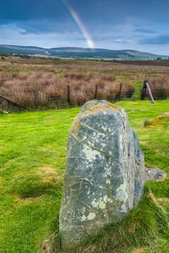
The site was originally a burial cairn of small stones surrounded by a 22m (72 feet) diameter kerb of standing stones and supported by an outer bank of stones. Only 7 upright stones remain, all roughly 1.3m (4.3 feet) tall. Another five stones have fallen on their sides.
These roughly-shaped stones are strikingly different to the tall, slender stones of Machrie Moor, visible just a short distance away on the other side of the farm track.
Getting There
Park at the signposted parking area on the coastal road 3 miles north of Blackwaterfoot. From the parking area, walk east along the farm track, signposted to the Machrie Moor stones, and you will see the Moss Farm Road site to your right after roughly 1km (0.6 miles).
About Moss Farm Road Stone Circle
Address: Blackwaterfoot, Isle of Arran, Arran, Ayrshire, Scotland
Attraction Type: Prehistoric Site
Location: 3 miles north of Blackwaterfoot, on the A841. Signed for Machrie Moor stone circle
Website: Moss Farm Road Stone Circle
Historic Scotland
Location map
OS: NR900 326
Photo Credit: David Ross and Britain Express
Opening Details: Open access site, usually accessible at any reasonable time
HERITAGE
 We've 'tagged' this attraction information to help you find related historic attractions
and learn more about major time periods mentioned.
We've 'tagged' this attraction information to help you find related historic attractions
and learn more about major time periods mentioned.
Historic Time Periods:
Find other attractions tagged with:
Bronze Age (Architecture) - Prehistoric (Time Period) - stone circle (Historical Reference)
NEARBY HISTORIC ATTRACTIONS
Heritage Rated from 1- 5 (low to exceptional) on historic interest
Machrie Moor Standing Stones - 0.6 miles (Prehistoric Site) ![]()
Auchagallon Stone Circle - 1.3 miles (Prehistoric Site) ![]()
King's Cave - 1.5 miles (Countryside) ![]()
The Doon Iron Age Hillfort - 2.3 miles (Prehistoric Site) ![]()
Auchencar Druid Standing Stone - 2.4 miles (Prehistoric Site) ![]()
Kilpatrick Dun - 4 miles (Prehistoric Site) ![]()
Torr a'Chaisteal Dun - 6 miles (Prehistoric Site) ![]()
Glen Rosa Waterfall Walk - 6.4 miles (Countryside) ![]()
Nearest Holiday Cottages to Moss Farm Road Stone Circle:
Nearby accommodation is calculated 'as the crow flies' from Moss Farm Road Stone Circle. 'Nearest' may involve a long drive up and down glens or, if you are near the coast, may include a ferry ride! Please check the property map to make sure the location is right for you.

Brodick, Strathclyde
Sleeps: 14
Stay from:£1,631 - £4,649