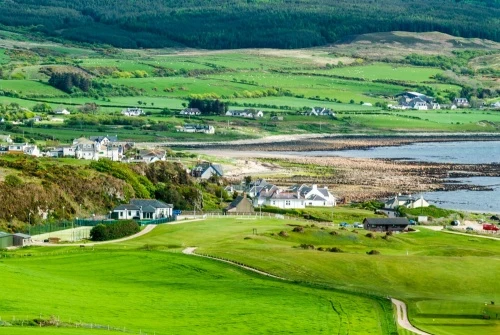
Blackwaterfoot is a small village in the south-west corner of Arran, at the mouth of the Clauchan Water river (aka Black Water), where it empties into Drumadoon Bay. The name comes from the Gaelic Bun na Dubh Abhainn, meaning 'bottom of the black river.'
Though the population is small, Blackwaterfoot is the largest settlement on the west side of Arran. It boasts a sandy beach and a lovely little harbour where sailboats bob at anchor.
The village began as the port for Shiskine, further inland. As the settlement around the harbour grew, it took over from Shiskine in importance. Just south of the village was a huge Neolithic burial cairn, but over time the cairn's stones were used for local construction projects. When the remains of the cairn were excavated in 1900 a bronze dagger, decorated with gold, was discovered.
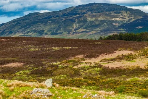
The Doon
This large Iron Age fortification occupies a headland north of Blackwaterfoot, near Drumadoon Point. The cliffs to the west provide natural defences, while on the landward side a stone wall, measuring up to 10 feet thick, rings the headland's summit. Much of the wall is gone now, its stones robbed.
The fort covers 12 acres, measuring roughly 415m x 170m. Six sherds of Grooved Ware pottery were found near the entrance on the east side.
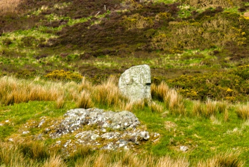
Within the boundary of The Doon is a solitary standing stone. The official National Record of the Historical Environment calls the stone 'unimpressive', which is probably fair. Unusually, the stone is wider than it is tall.
Golf Course
Blackwterfoot is the home of a 12-hole golf course, one of only two in Europe. The golf course was laid out in 1896 as the village began to develop as a centre for tourism.
Immediately north of the village at Drumadoon Point is an Iron Age fort, the largest such fort on Arran. If you follow the Arran Coastal Way footpath past the fort you come to King's Cave, a natural cave set into the sandstone cliffs. King's Cave is said to be the place where King Robert Bruce was inspired by watching a spider's repeated attempts to spin a web to try again to claim the throne of Scotland.
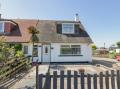
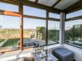
Blackwaterfoot has in recent years become a popular resort centre catering to tourists, with a large number of holiday cottages.
The village lies at the western end of The String Road (or simply, The String) an 11-mile-long mountain route connecting Blackwaterfoot on the west coast to Brodick on the east. The road was laid out in 1817 by the famous Scottish engineer, Thomas Telford.
Being on the west coast of Arran, with sweeping views west towards the Mull of Kintyre and beyond, Blackwaterfoot is a perfect place to watch spectacular sunsets.
Getting There
Blackwaterfoort is at the southwestern end of The String Road, and can also be reached by the coastal road from Whiting Bay or from Machrie, to the north. It is on the Arran Coastal Way long-distance footpath.
There is a parking area with toilets near the harbour, and further parking near the golf course.
Just be aware that Blackwaterfoot is a very popular tourist destination, and in the summer months it can be a challenge to find a free parking space!
About Blackwaterfoot
Address: Blackwaterfoot, Isle of Arran, Arran, Strathclyde, Scotland
Attraction Type: Village
Location: Off the southwestern end of The String Road (the B880).
Location map
OS: NR896281
Photo Credit: David Ross and Britain Express
POPULAR POSTS
NEARBY HISTORIC ATTRACTIONS
Heritage Rated from 1- 5 (low to exceptional) on historic interest
The Doon Iron Age Hillfort - 0.9 miles (Prehistoric Site) ![]()
Kilpatrick Dun - 1.4 miles (Prehistoric Site) ![]()
King's Cave - 1.9 miles (Countryside) ![]()
Machrie Moor Standing Stones - 2.8 miles (Prehistoric Site) ![]()
Moss Farm Road Stone Circle - 2.8 miles (Prehistoric Site) ![]()
Torr a'Chaisteal Dun - 3.4 miles (Prehistoric Site) ![]()
Auchagallon Stone Circle - 4 miles (Prehistoric Site) ![]()
Auchencar Druid Standing Stone - 5.1 miles (Prehistoric Site) ![]()
Nearest Holiday Cottages to Blackwaterfoot:
Nearby accommodation is calculated 'as the crow flies' from Blackwaterfoot. 'Nearest' may involve a long drive up and down glens or, if you are near the coast, may include a ferry ride! Please check the property map to make sure the location is right for you.

Brodick, Strathclyde
Sleeps: 14
Stay from:£1,655 - £4,257