One of the most popular walks on Arran is a 5-mile loop through Glen Sannox, beginning and ending in Brodick.
Most people take this walk in a counter-clockwise direction, starting near the Arran Brewery and following the Goatfell trail before branching off onto the Cnocan Gorge Trail and looping through Glen Rosa to emerge at the Glen Rosa Campground at the head of the glen.
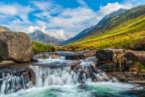
That walk is wonderful, but it can take up to 3 hours to complete. There's a shorter version that is a simple 'there-and-back' route, beginning and ending at the campground and taking in the Blue Pool, a popular wild swimming spot, and a beautiful waterfall on Glenrosa Water, under the shadow of Goatfell.
The Walk
From Brodick take the B880 (The String Road) in the direction of Machrie. Roughly 200m past the beginning of the String Road you come to a lane on the right, immediately before the Old Brodick Burial Ground. The lane is signposted from the east (Brodick) but, as far as we could see, not from the west (Machrie). The signpost reads 'Cart Track, Glen Rosa'.
We parked at the burial ground, which was linked to the former Glenshurig Church, now demolished. From there simply walk down the lane, a distance of 1 mile, to the Glen Rosa Campground. Alternatively, drive to the end of the lane and pull well off onto the verge. That shortens the walk distance by 1 mile.
Simply walk through the gate, through the campground, keeping to the obvious track that leads along the south bank of Glenrosa Water. This track begins as a rough vehicular road but soon becomes a walking trail.
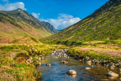
For the first 800m the track hugs the northern boundary of a forest plantation, eventually emerging into open ground. There is a steep slope to your left, leading to the summit of Cul nan Creagan, while on the opposite side of Glenrosa Water is Glenshant Hill, and beyond it, Goatfell itself.
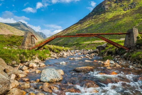
You pass the remains of a concrete and iron bridge that once spanned the river. The route bends gradually north, and Goatfell is clear ahead and to your right. The view north up the glen begins to open up and you can soon see Cir Mhor in the distance.
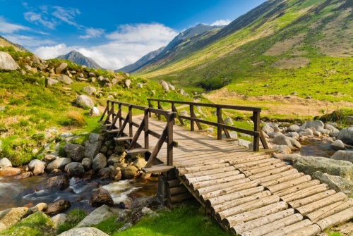
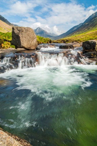
You come to the confluence of Glenrosa Water and its tributary, Garbh Allt, and a timber footbridge takes you to the northern bank. There the path splits, with the left-hand fork following Garbh Allt. Keep right along Glenrosa Water and within 100 yards you come to the Blue Pool, a favoured spot for wild swimming. At the head of the pool is a small waterfall.
From here the view north towards Cir Mhor is stunning, with the mountain peak framed by the steep sides of Beinn a' Chliabhain to the left and Goatfell to the right. This view is a favourite of landscape photographers and has appeared in many calendars and in advertisements for Arran Aromatics.
From the Blue Pool and its waterfall simply retrace your steps along the glen to the campground and up the lane to the burial ground..
From the burial ground to the Blue Pool is roughly 2.8 miles or 4.6km and the going is easy. From the campground to the waterfall is much shorter; roughly 1.8 miles.
Whether you opt for the more common circular loop from central Brodick or my alternate version, the Glen Rosa walk is well worth it. If you plan on photographing the iconic view up the glen to Cir Mhor, the best time of day is in the early morning.
About Glen Rosa Waterfall Walk
Address: off the B880 (String Road),
Brodick,
Isle of Arran,
Arran,
Strathclyde,
Scotland
Attraction Type: Countryside - Waterfall
Location: Exit off the String Road to Glen Rosa, park at the Old Burial Ground or at the Glen Rosa Campground.
Location map
OS: NR982389
Photo Credit: David Ross and Britain Express
HERITAGE
 We've 'tagged' this attraction information to help you find related historic attractions and learn more about major time periods mentioned.
Find other attractions tagged with:
NEARBY HISTORIC ATTRACTIONS
Heritage Rated from 1- 5 (low to exceptional) on historic interest
Goatfell - 1.7 miles (Countryside) ![]()
Arran Heritage Museum - 2.2 miles (Museum) ![]()
Brodick Castle - 2.2 miles (Historic House) ![]()
North Glen Sannox Waterfall Walk - 4.9 miles (Countryside) ![]()
Auchencar Druid Standing Stone - 5.9 miles (Prehistoric Site) ![]()
Machrie Moor Standing Stones - 6 miles (Prehistoric Site) ![]()
Auchagallon Stone Circle - 6.1 miles (Prehistoric Site) ![]()
Moss Farm Road Stone Circle - 6.4 miles (Prehistoric Site) ![]()
Nearest Holiday Cottages to Glen Rosa Waterfall Walk:
Nearby accommodation is calculated 'as the crow flies' from Glen Rosa Waterfall Walk. 'Nearest' may involve a long drive up and down glens or, if you are near the coast, may include a ferry ride! Please check the property map to make sure the location is right for you.
More self catering near Glen Rosa Waterfall Walk


