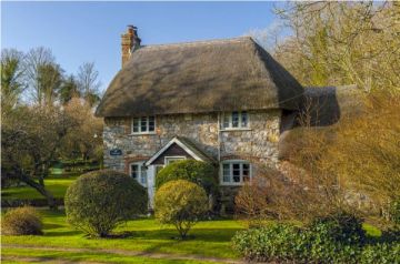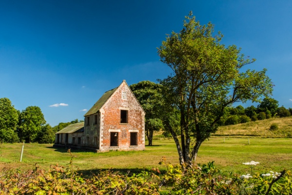
The deserted village of Imber, Wiltshire, is a fascinating time capsule. The village was taken over by the military in 1943 so it could be used to train American soldiers for the D-Day landings. The villagers were given 6 weeks to pack their belongings and leave. They were assured that once the war was over they would be allowed to return.
The military never gave Imber back to the residents, however, and more than 70 years later it remains in the heart of the Salisbury Plain training area and off-limits to visitors except for a few weeks each year.
History
There was a settlement at Imber at least as early as the 10th century, when the area was held by the Abbess of Romsey. The abbess retained part-ownership at the time of the Domesday Book of 1086, with the Earl of Hereford owning the rest. During the medieval period the Imber estate was owned by the Hungerford and De Rous families, until it passed at last to the Thynne family of Longleat.
The military began using Salisbury Plain for training in 1897, and during WWI Imber Court was used to house troops. In 1927 the War Office began buying up land in Imber and leasing it back to the residents. The military owned the entire village and the surrounding farmland by 1932, so perhaps it should have come as no surprise that with the Normandy landings looming, the villagers were told to leave.
On 1 November 1943 the villagers were called to a public meeting in the schoolroom and told they had 47 days to leave. They were assured they could return in 6 months, but the promised return ever materialised.
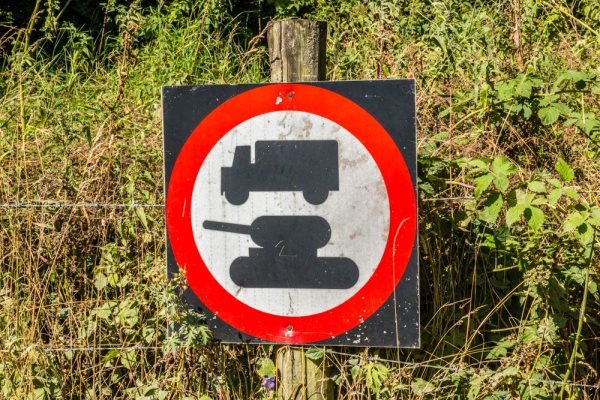
Despite assurances given at the time, the military did not allow residents to return after the war, but continued to use the site for training purposes. They built a special Urban Warfare Training unit to prepare soldiers for house-to-house fighting in urban areas around the world. Most of the village is gone, but what remains gives a fascinating glimpse into its history and its military use.
The only building in Imber that is regularly open to visitors is the historic medieval church of St Giles, which is cared for by the Churches Conservation Trust. The rest of the buildings are off-limits to visitors, but you can explore the main street and see the historic buildings that remain, including several that date to at least the 18th century.
What to See
Here's a look at what there is to see in Imber, starting from the west and working east. Note that most of the properties are off limits to visitors and can only be viewed from the exterior. The only exception to this is the Baptist cemetery and St Giles church. All other properties can only be viewed from the roadside or, in the case of Imber Court, through a gate. Please respect the military 'keep out' signs.
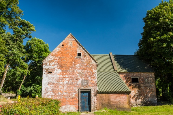
The Bell Inn
An attractive brick building on the main road, the Bell was a pub owned by Usher's brewery. On the west gable is a datestone with the year 1769, under the initials PF. There seems to be no record of who 'PF' was, but the date is clearly when The Bell was erected, or rebuilt in its present formUshers continued to pay the annual pub license fee until the 1960s, hoping that the villagers would be allowed to return.
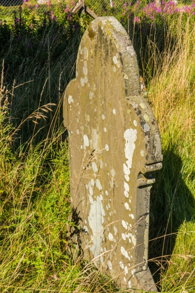
Baptist Chapel Burial Ground
Immediately east of The Bell a signposted trail leads across the grass to an overgrown fenced area to te cemetery for the Baptist chapel. The chapel itself stood further up the slope, but was pulled down in the 1970s. Though the cemetery is overgrown, you can wander about and view quite a number of old gravestones. You can also get a very good view of the nearby council houses.
Over half of Imber's residents belonged to the Baptist movement. Until 1833 they had to worship in local houses, but in that year a new chapel was built, for a total cost of ã238. In 1858 a school was attached to the chapel. The school had an attendance of twice the Church of England school. It eventually closed in 1895 when state-funded education became the norm.
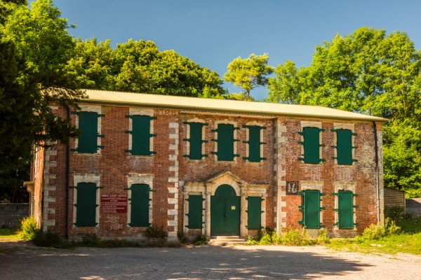
Imber Court
On the opposite side of the main road from the Bell Inn and the Baptist cemetery you will find high stone wals enclosing Imber Court, a beautiful 17th century manor house, rebuilt in the 18th century. The Court was damaged by fire in 1920 and restored. It was built by the Wadman family, lords of the manor during the 17th and 18th centuries. When the Wadman's sold the Court it was used as an academy for young gentlemen before the Dean family took ownership. The Dean's were lords of the manor throughout the 19th century and owned 3 local farms.
Nothing now remains of the Court's gardens and lawns, and barbed wire along the stone wall belies the elegance of the historic buildings beyond. You can still see traces of an avenue of trees leading to the dog kennels. A lane runs past the Court towards Imber Court Farm, but the lane is closed to visitors.
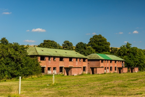
Council Houses
The next place to see two large council houses, erected in 1938, just 5 years before the village was deserted. There were originally 8 council houses, but 6 of these were pulled down by the military.

Urban Warfare Training Units
Perhaps the most fascinating feature at Imber is this purpose-bult military training area, with simple rectangular houses for training troops in house to house combat. The Uran Warfare units were used prepare troops for combat in places like Northern Ireland, Kosovo, and Afghanistan.
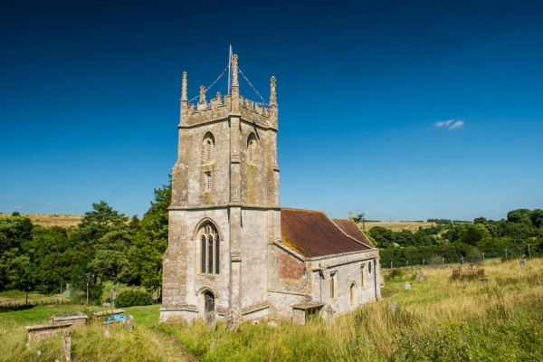
St Giles Church
Beside the urban warfare units a paved road leads uphill to St Giles Church. The church dates to at least the 13th century, and stands on the site of an earlier Norman church. The super Perpendicular west tower was added in the 15th century. The most interesting feature is a series of medieval wall paintings, including the Weighing of Souls, and the Seven Deadly Sins. On unusual highlight is a painted mural under the tower depicting plain changes for bell-ringers. Think of them as a musical score for bell-ringers. The pain changes mural dates to 1692 and is thought to be the oldest in England. St Giles is a wonderful medieval church and is worth worth a trip to explore on open days. One day in the year it is sure to be open is the closest Sunday to St Giles's Day.
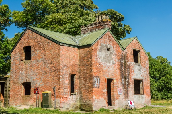
Nag's Head Cottages
If you carry on east past St Giles Church you will see the Nag's Head Cottages on the opposite side of the road. This set of two semi-detached cottages take their names from the former Nag's Head pub which formerly occupied the property. Records are scanty, but the pub seems to have closed in the early 19th century, and the cottages were used as dwellings after that time.
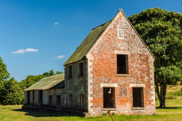
Seagram's Farm
Just past the Nag's Head Cottages in the final historic building at Imber, Seagram's Farm, built, or rebuilt, in 1880 according to a datestone on its gable. Its name comes from its owner, Edward Seagram, who is known to have owned the property from 1832, though he seems to have rented it out to the Dean family, who farmed an area of 1000 acres.
Visiting
Imber village is still used by the military and is part of the Salisbury Plain train area. Access is restricted to just a few weeks of opening times each year, usually once in the spring, summer, and at Christmas. By far the best way to keep up to date with opening times is to subscribe to the newsletter of the Imber Church website at http://www.imberchurch.org.uk/.
The most interesting way to visit Imber is to take the Imberbus, a restored red Routemaster bus that makes special trips from Warminster several days a year.
The easiest way to reach Imber is from Warminster. Directions are easy; just take Imber Road off the B3414 on the southern edge of Warminster. The road takes you past a set of military checkpoints which are unmanned on open days. Just carry on straight and you enter the military training area, where you can see old rusted tanks by the side of the road.
Please obey the signs warning of unexploded military ordnance and do not leave the roadway! After 6 miles you will enter Imber, and there are several large parking areas. We came on a sunny Saturday in August and there were perhaps a few dozen people wandering about, and a half-dozen friendly volunteers in the church selling baked goods and homemade jams.
About Imber
Address: Imber,
Wiltshire,
England
Attraction Type: Village
Location: In a military training area. Limited opening to visitors. Access off Imber Road, Warminster.
Location map
OS: ST965485
Photo Credit: David Ross and Britain Express
HERITAGE
 We've 'tagged' this attraction information to help you find related historic attractions and learn more about major time periods mentioned.
Historic Time Periods:
Find other attractions tagged with:
10th century (Time Period) - 13th century (Time Period) - 15th century (Time Period) - 16th century (Time Period) - 17th century (Time Period) - 18th century (Time Period) - 19th century (Time Period) - Domesday Book (Historical Reference) - Medieval (Time Period) - Norman (Architecture) - Perpendicular (Architecture) - Tudor (Time Period) - wall paintings (Historical Reference) -
NEARBY HISTORIC ATTRACTIONS
Heritage Rated from 1- 5 (low to exceptional) on historic interest
Imber, St Giles Church - 0 miles (Historic Church) ![]()
Edington Priory Church - 3.8 miles (Historic Church) ![]()
Bratton, St James Church - 3.8 miles (Historic Church) ![]()
Bratton Camp Hillfort - 4.5 miles (Prehistoric Site) ![]()
Heytesbury, St Peter & St Paul Church - 4.5 miles (Historic Church) ![]()
Knook, St Margaret's Church - 4.5 miles (Historic Church) ![]()
Westbury White Horse - 4.6 miles (Prehistoric Site) ![]()
Upton Lovell, St Augustine of Canterbury Church - 5 miles (Historic Church) ![]()


