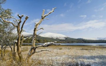
Ord Photo Gallery

Ord, Sleat Peninsula, Skye

On a recent visit to Skye we had the pleasure of joining an outing led by a ranger from Scottish Natural Heritage at Ord beach, on the Sleat Peninsula (thanks, Lindsey!). Here are some photos from that very enjoyable outing. We hope this helps give a flavour for the type of lovely scenery and natural life you can experience on Skye. It is well worthwhile simply donning a pair of wellies and poking about in tidepools along the shore when the tide is out.

Starfish and crabs at Ord, Isle of Skye
Starfish at Ord, Skye
Ord,  Isle of Skye, crab
Ord, Isle of Skye, crab
Shells on Ord beach, Isle of Skye
Tidepool Ord, Sleat Peninsula,  Isle of Skye
Tidepool Ord, Sleat Peninsula, Isle of Skye
Ord, Sleat Peninsula,  Isle of Skye, Seaweed
Ord, Sleat Peninsula, Isle of Skye, Seaweed
Crab at Ord, Sleat Peninsula,  Isle of Skye
Crab at Ord, Sleat Peninsula, Isle of Skye
Seaweed, Ord, Sleat Peninsula,  Isle of Skye
Seaweed, Ord, Sleat Peninsula, Isle of Skye
Worm castings, Ord, Sleat Peninsula,  Isle of Skye
Worm castings, Ord, Sleat Peninsula, Isle of Skye
The beach at Ord, Isle of Skye
Ord beach, Sleat Peninsula, Skye
Ord, Skye, the beach

Related

Sleat Peninsula

Attraction search
in
Britain Express Canvas Prints

Stunning UK prints for sale by award-winning photographer David Ross, editor of Britain Express, the UK Travel and Heritage Guide.

More Isle of Skye

Ordnance Survey maps

Ordnance Survey mapOutdoor Essentials!

Ordnance Survey Maps for the Isle of Skye

(External website links)

Explorer OS maps
(1: 25000)
EX411 Cuilins
EX412 Sleat
EX409 Raasay Rona & Scalpay
EX408 Trotternish
EX410 Portree & Bracadale
EX407 Dunvegan

Landranger OS Maps
(1: 50000)
LR 032 South Skye & Cuillins
LR 023 North Skye

Passionate about British Heritage!