Ashton Keynes is a picturesque village in the Cotswold Water Park, close to the Wiltshire border with Gloucestershire and about 6 miles south of Cirencester. Evidence of Bronze Age and Iron Age activity has been found in the parish but it seems that there was no permanent settlement until the late 7th century.
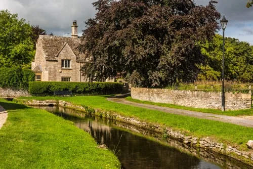
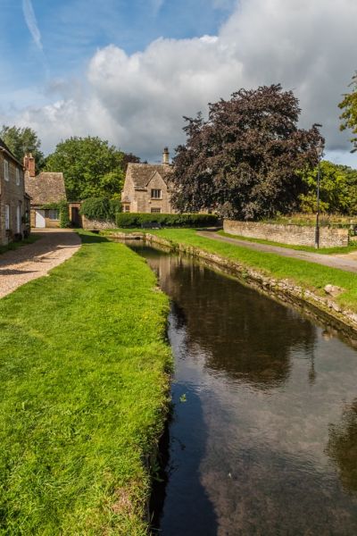
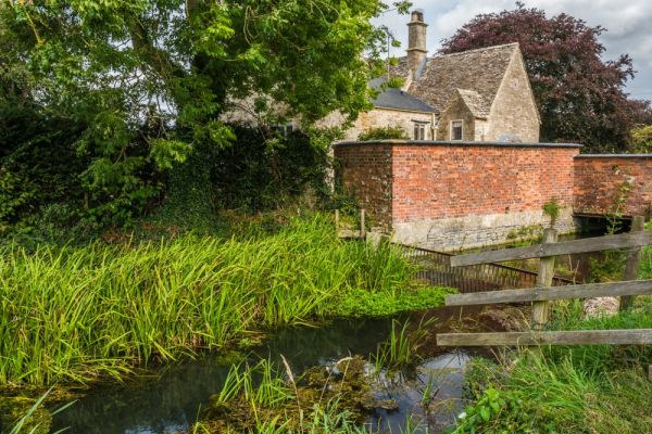
The settlement may have grown up around Ashton Mill, at the end of Church Walk. The mill we see today was just one of five Saxon mills on the River Thames, powered with water from a leat connecting to the river.
History
Ashton grew up on the border between Mercia and Wessex, which might explain why it became a royal estate owned by the kings of Wessex. Alfred the Great bequeathed Ashton to his daughter Aelfthryth, but by the time of the Domesday Book of 1086 the village was owned by Cranborne Abbey in Dorset. From 1102 the estate passed to the monks of Tewkesbury Abbey.
The abbey held Ashton until it was suppressed by Henry VIII in 1539.
In 1265 the tenancy of Ashton passed to Robert de Keynes of Somerford Keynes. Curiously, it was another 200 years before Ashton had the 'Keynes' suffix added to its name, to help distinguish it from other English villages named Ashton.
Robert de Keynes passed the tenancy to his son, also named Robert. In 1299 the younger Robert sold Ashton to John de Sancto Amando. The only trouble was that Robert did not have the right to sell the freehold of the property; he was only a tenant. The Abbot of Tewkesbury not surprisingly objected and took Robert Keynes to court. It took seven years but the abbot proved his case and recovered the property.
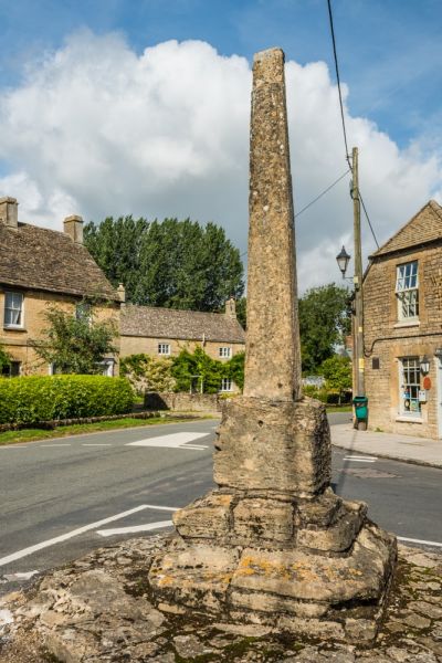
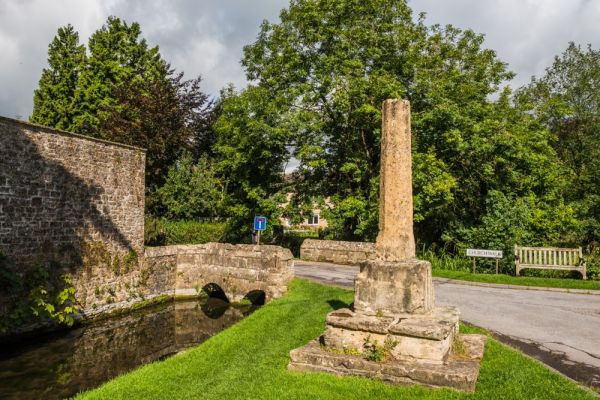
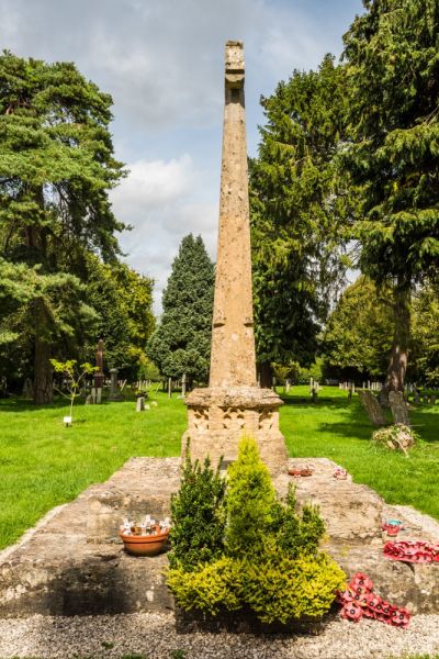
This court case prompted the Abbey to manage the estate directly rather than lease it. Around 1320 the Abbey created a planned town, based around Fore Street, Back Street, Gosditch, and High Road. They erected an administrative building at Park Place, linked to the church by four roadside crosses. These crosses still stand today and are one of Ashton's most memorable historic structures, a reminder of the power of Tewkesbury Abbey in the medieval period.
Ashton became the largest settlement in the area, even after the devastation of the Black Death.
The village passed into private hands after the Dissolution of the Monasteries. It was owned first by Sir John Hungerford, whose descendants sold it to Sir John Evelyn. A later owner was Henry Whorwood, who enclosed common land and laid out the current pattern of fields. Whorwood went bankrupt and his mortgager foreclosed on him.
In 1845 the village was purchased by the Duke of Cleveland, one of the largest landowners in Britain. By the time of his death, the Duke owned a staggering 102,000 acres of property across the country, so perhaps it is not surprising that he never set foot in Ashton Keynes.
Ashton Keynes developed as a centre for farming during the medieval and Tudor periods, unlike nearby towns like Cricklade which became commercial centres. From the Stuart period, there was a thriving tanning industry, with leather goods like gloves and boots made locally. The main industry, however, was gravel quarrying.
The first gravel quarries opened in the 18th century but it was the building of the M4 in the 20th century that essentially turned Ashton Keynes into an island surrounded by gravel pits. When quarrying ceased the pits were flooded to create the Cotswold Water Park, with over 100 lakes creating boating and other leisure activities such as walking, cycling, and birdwatching.
Historic Ashton Keynes
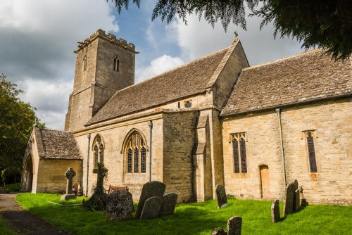
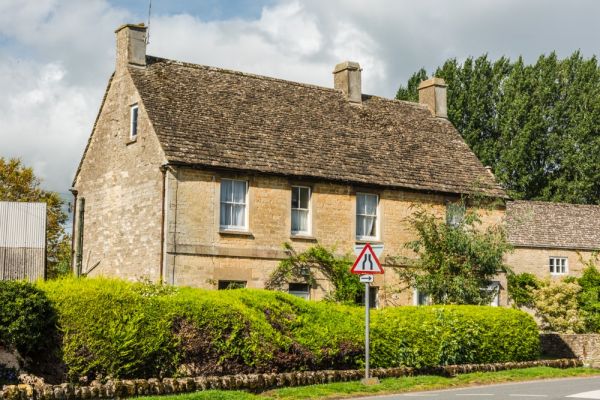
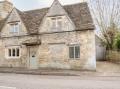
There are 69 listed buildings in Ashton Keynes, most of these are centred on Fore Street and the medieval church of Holy Cross. Among the latter is the Old Vicarage, built in 1584. A short stroll from the Old Vicarage is Mill House, begun in the 16th century with a 17th-century rear wing.
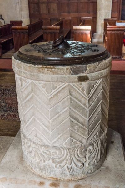
Then there is the church itself, begun in the 12th century on the site of an earlier building. Highlights include a 12th-century tub font, a restored 12th-century chancel arch, and a 15th-century wagon roof with carved bosses.
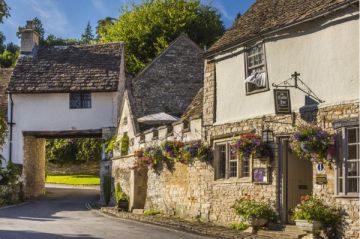
On High Road is Ashton House, built in the early 17th century and once a busy tannery. Further along High Road is London House, built around 1604 as a combination shop and dwelling. Look for six Tudor carved heads under the eaves. Then there is Cock's Thatch, a picturesque 17th-century thatched cottage incorporating 14th-century cruck beams.
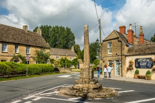
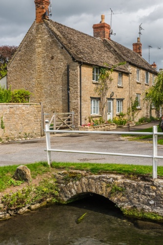
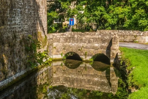
Leading from High Road to Church Walk is Gumstool Bridge, a late medieval bridge over the infant River Thames. At one end of the bridge stands one of Ashton's medieval crosses, now without its top. The cross is thought to date to the 1320s, as does the wayside cross near the village hall and a third cross at the junction of High Road and Park Place, outside the White Hart Inn. The fourth medieval cross stands in the churchyard and acts as the village war memorial.
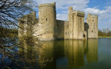
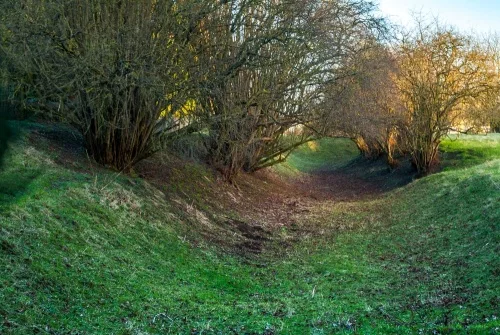
Immediately south of the churchyard is Hall Close, a medieval ringwork and bailey fortification built around 1140. The ringwork is thought to be the only surviving feature of a castle built in the reign of King Stephen, during the turbulent civil war known as The Anarchy. You can easily follow the course of the earthworks, though there is no sign of the castle above ground.
You can also see the remains of a moated site at nearby Church Farm, which was owned by Tewkesbury Abbey.
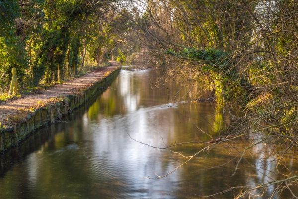
These are just a few of the most interesting and attractive historic buildings you can see while strolling around the village. The Thames Path leads directly through Ashton Keynes, and our family has enjoyed a lovely walk along the path to the neighbouring village of Somerford Keynes to see its wonderful Saxon church.
Getting There
Ashton Keynes is just off the Spine Road (West), reached from the A419 six miles south of Cirencester. There is no obvious parking area but we easily found a place to park along the road in the centre of the village.
More Photos

About Ashton Keynes
Address: Ashton Keynes, Wiltshire, England
Attraction Type: Village
Location: Off Spine Road (West) in the Cotswold Water Park, six miles south of Cirencester
Website: Ashton Keynes
Location map
OS: SU045940
Photo Credit: David Ross and Britain Express
NEARBY HISTORIC ATTRACTIONS
Heritage Rated from 1- 5 (low to exceptional) on historic interest
Ashton Keynes, Holy Cross Church - 0.3 miles (Historic Church) ![]()
Leigh, All Saints Church - 1.5 miles (Historic Church) ![]()
Somerford Keynes, All Saints Church - 2.1 miles (Historic Church) ![]()
South Cerney, All Hallows Church - 2.1 miles (Historic Church) ![]()
Shorncote, All Saints Church - 2.1 miles (Historic Church) ![]()
Cricklade, St Sampson's Church - 3.3 miles (Historic Church) ![]()
Down Ampney, All Saints Church - 3.6 miles (Historic Church) ![]()
Driffield, St Mary's Church - 4 miles (Historic Church) ![]()
Nearest Holiday Cottages to Ashton Keynes:
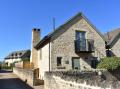
Cotswold Water Park, Gloucestershire
Sleeps: 8
Stay from:£1,017 - £4,626
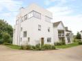
Cotswold Water Park, Gloucestershire
Sleeps: 10
Stay from:£1,540 - £5,175
South Cerney, Gloucestershire
Sleeps: 6
Stay from:£890 - £3,194