Overton Hill, near Avebury to Ivinghoe Beacon
I like to think of this marvelous path as history underfoot. There must be more reminders of England's ancient history along this path than on any other three paths put together.
The start of the path is just down the road from the stone circle at Avebury, and almost in sight of the mysterious conical mound of Silbury Hill. And that's just the beginning.
The path wends its way across the chalk downs through at least three more hill forts, and passes within feet of the burial mound at Wayland's Smithy and the White Horse at Uffington. The landscape is more varied after Goring, where the path crosses the Thames before climbing into the deciduous groves of the Chiltern Hills.
The scenery is exhilarating, and if you have the luck to reach Ivinghoe Beacon on a blustery day you'll find it crowded with locals flying every sort of kite imaginable.
The Ridgeway joins with the Icknield Way and the Wessex Ridgeway to form a continuous path along the chalk ridge reaching almost from the south coast all the way to East Anglia.

Highlights:
Avebury Stone Circle
Silbury Hill
Barbury Castle hill fort
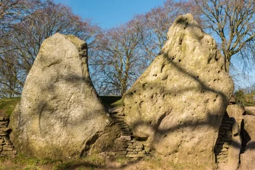
Wayland's Smithy burial mound
Uffington White Horse
Chilterns AONB
Maps
Ordnance Survey maps covering the Ridgeway Path National Trail:
Explorer OS maps (Scale: 4cm = 1 km / 1: 25000) - best for walking
EX157, EX170, EX171, EX181
Landranger OS maps (Scale: 2cm = 1km / 1: 50000)
LR165, LR173, LR174, LR175
All OS maps are available at 10% off retail price, by special arrangement if you order through Britain Express. Both laminated waterproof and plain paper maps are available.
Guidebooks & Accommodation
The Ridgeway (National Trail Guides), by Anthony Burton.
The Ridgeway Companion is a guide packed full of details of facilities and services relevant to walkers, cyclists and horseriders. Available by clicking the link above or from the National Trails Office (see below).
Public transport leaflet (free/SAE) by and from the National Trails Office.
Stillwell's National Trail Companion by Tim Stillwell and Dean Conway, Stillwell Publications - lists accommodation on and near national trails throughout the UK and Ireland
The Rambler's Yearbook and Accommodation Guide published by the Rambler's Association - lists accommodation and walking resources.
The Greater Ridgeway - A complete guide to the entire Ridgeway from Lyme Regis to Hunstanton on the Norfolk coast, combining the Icknield Way with the Wessex Ridgeway and the Peddar's Way, a total of 580 km.
Useful Contacts
Friends of the Ridgeway
c/o Peter Gould
18 Hampton Park
Bristol BS6 6LH
Ramblers Association
2nd Floor, Camelford House
87-90 Albert Embankment
London, SE1 7TW
Web: http://www.ramblers.org.uk/
National Trails Office
Environment and Economy
Holton
Oxford OX33 1QQ
Email: Nationaltrails@oxfordshire.gov.uk
Web: www.nationaltrail.co.uk