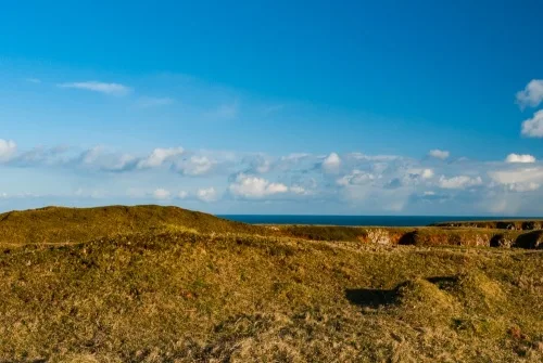
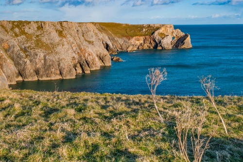
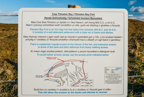
Flimston Bay Fort is an Iron Age promontory fort in a spectacular location on a high cliff overlooking Flimston Bay, near Castlemartin, just east of the well-known sea stack known as the Green Bridge of Wales. The fort was erected sometime between 600 BC and 43 AD.
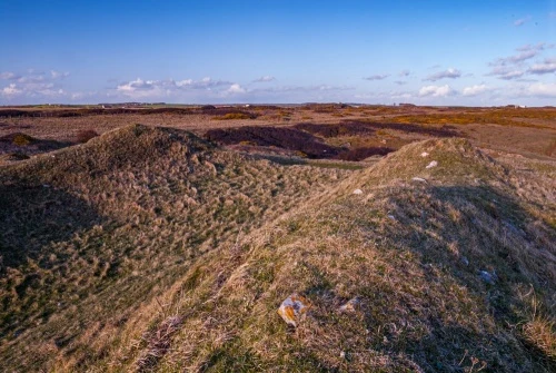
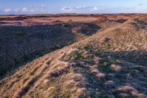
The fort is defended by a series of three earthen banks and ditches on the landward side, enclosing an area of roughly 1.6 hectares. Within this space the ground slopes dramatically. On the eastern side of the fort interior are a number of shallow hollows that may represent platforms for supporting huts.
Note: you may see the fort called by several other names, including Flimston Bay Camp, Flimston Bay Promontory Fort, and Flimston Castle. The names all describe the same site.
The outer defensive banks are curved and measure 120m from end to end. There is a central entrance on the northern (landward) side, with a double bank and ditch to the west. This double bank is 1m high and 10m wide, rising 1.1m high.
To the east of the entrance the defences are cut into the slope of the land. Here you will see two scraps rising 3m high protected by an outer ditch 12m wide and 1.2m deep. Roughly 30m north of this ditch is a thirds bank, 8m wide and 1.4m high. This outer bank has been damaged over time and may have been added at a later date than the inner banks.
The space between the inner and outer banks could have been used as an animal enclosure, or as a meeting place for trading.
The fort has suffered badly from erosion in places due to the large number of visitors over the years, so please follow the signposted advice and use the northern gap in the defences to access the fort interior.
Flimston Bay Fort is in a stunning coastal location, with fabulous views. It is well worth the short walk from the Green Bridge of Wales car park!
Getting There
The easiest way to reach Flimston Bay Fort is by footpath along the cliffs from the Green Bridge of Wales parking area. From Castlemartin village take the B4319 towards Merrion and turn right on the minor lane leading south to the Green Bridge. The route goes through an MOD artillery range and is subject to closure at any time. The route follows the Pembrokeshire Coastal Path and the Wales Coast Path long-distance trails.
From the Green Bridge car park simply follow the signposted trail east along the cliffs to Flimston Bay Fort, a distance of about 700m.
About Flimston Bay Fort
Address: Pembrokeshire Coast Path, Castlemartin, Pembrokeshire, Wales
Attraction Type: Prehistoric Site
Location: On the coastal path 700m east of the Green Bridge of Wales car park, southeast of Castlemartin village.
Website: Flimston Bay Fort
Location map
OS: SR934949
Photo Credit: David Ross and Britain Express
NEARBY HISTORIC ATTRACTIONS
Heritage Rated from 1- 5 (low to exceptional) on historic interest
Green Bridge of Wales & Stack Rock - 0.6 miles (Countryside) ![]()
St Twynnells Church - 1.8 miles (Historic Church) ![]()
Bosherston, St Michael and All Angels - 2 miles (Historic Church) ![]()
Bosherston Lakes (Lily Ponds) - 2.1 miles (Garden) ![]()
St Govan's Chapel - 2.4 miles (Historic Church) ![]()
Stackpole Estate - 2.5 miles (Garden) ![]()
St Petrox Church - 2.7 miles (Historic Church) ![]()
Stackpole Court & Walled Gardens - 2.7 miles (Garden) ![]()