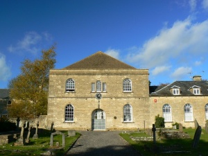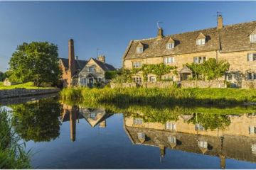
If ever a place deserved the often over-used cliché, "undiscovered gem," Chalford is the place! Generally overlooked by the hordes of tour buses that descend upon places like Bourton-on-the-Water and Broadway, Chalford is located in a ridiculously lovely valley bounded by strikingly steep hillsides. So steep are the hills in fact, that for two months of the year the sun does not reach the valley bottom.
In a sense, Chalford's location is representative of the characteristic geography of the western Cotswolds, where the valleys are sharp, almost alpine in nature. Contrast this landscape with the gentle folds of land that stretch out eastwards towards the Thames Valley.
The Chalford area has produced many archaeological finds, and the remains of several round barrows and long barrows can be seen within the parish.
The area was settled heavily by Huguenot refugees in the 17th century, and these brought expertise in weaving and related cloth industries. Many fine period houses dot the hills about Chalford, a testament to the prosperity brought by the cloth industry.
Related:
Cotswolds
About Chalford
Address: Chalford,
Cotswolds,
Gloucestershire,
England
Attraction Type: Village
Location map
OS: SO898 030
Photo Credit: Brian Robert Marshall, licensed for reuse under the Creative Commons Licence
POPULAR POSTS
HERITAGE
 We've 'tagged' this attraction information to help you find related historic attractions and learn more about major time periods mentioned.
Find other attractions tagged with:
NEARBY HISTORIC ATTRACTIONS
Heritage Rated from 1- 5 (low to exceptional) on historic interest
Sapperton, St Kenelm's Church - 3 miles (Historic Church) ![]()
Windmill Tump - 4.2 miles (Prehistoric Site) ![]()
Rodmarton Manor - 4.3 miles (Historic House) ![]()
Misarden Park Gardens - 4.3 miles (Garden) ![]()
Coates, St Matthew's Church - 4.9 miles (Historic Church) ![]()
Painswick Rococo Garden - 5.1 miles (Garden) ![]()
Chavenage House - 5.2 miles (Historic House) ![]()
Duntisbourne Abbots, St Peter's Church - 5.4 miles (Historic Church) ![]()
Nearest Holiday Cottages to Chalford:
Minchinhampton, Gloucestershire
Sleeps: 5
Stay from: £599 - 2598
More self catering near Chalford


