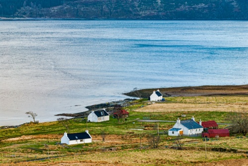
Kylerhea is a remote hamlet on the east coast of Skye, best known for two things; it is the Skye terminus of the summer ferry from Glenelg on the mainland, and it is home to an otter sanctuary.
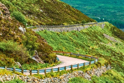
On the landward side, Kylerhea can only be reached by a narrow and winding single-track road that passes through the steep-sided valleys of Glen Arroch and Kylerhea Glen. The road from Broadford reaches the highest elevation of any road on Skye at 279 metres above sea level.
The village name means 'the straits of Reatha' and is also applied to the narrows separating Kylerhea from Glenelg on the Scottish mainland. Traditionally, Kylerhea is said to have been named for the mythical Celtic hero Rhea, who lived in Glenelg.
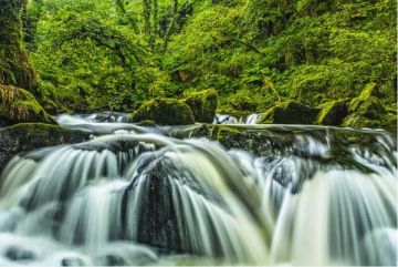
Kylerhea Otter Hide
Kylerhea's remote location on the coast has made it a popular habitat for otters. The Forestry Commission maintains an otter hide for visitors to spot these elusive mammals. This is one of the best places in Scotland to spot otters in their natural habitat. If you're lucky, you might also see dolphins, seals, or even sharks. You could even spot the largest bird of prey in Britain, the white-tailed sea eagle.
Access is straightforward. Take the signposted lane off to the left about 800m before you reach the ferry slipway. There is a car park and picnic area a hundred metres up the lane. From there, simply walk down the lane as it parallels the shore until you reach the otter hide.
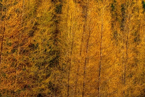
There is a toilet block and several benches along the route. Information panels provide details about local geology and animal life. The route passes through a forested area -- gorgeous in autumn when vibrant colours turn rowan and birch leaves a brilliant mix of reds, golds, and yellows.
At about the 1km mark a signposted trail leads off to the right. This takes you to the timber-framed otter hide, where you will find more information boards about what animal and birdlife to see. A set of powerful binoculars is available inside the hut (or, of course, you can bring your own!).
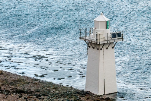
Kylerhea Minor Light
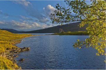
From the hide you can see Kylerhea Minor Light, a small lighthouse on the shore operated by the Northern Lighthouse Board. The lighthouse stands just 7m high (about 23 feet) and was built in 1892 to a design by the famous Stevenson family of engineers. The lighthouse was always intended to be an unmanned beacon. It is now remotely operated by the Northern Lighthouse Board from its headquarters in Edinburgh.
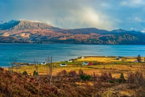
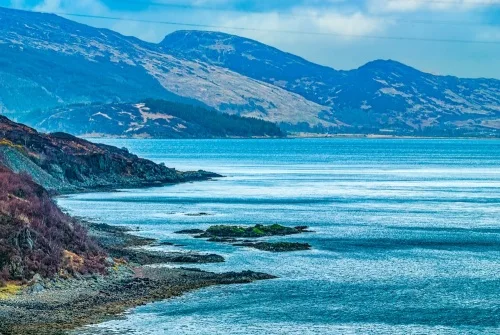
From the hide you also get wonderful views across the strait of Kyle Rhea to Glenelg and the mountain peaks of Kintail on the mainland.
The Glenelg Ferry
There has been a ferry linking Kylerhea to Glenelg for at least 500 years, but the first car ferry was launched in 1935. Before the Skye Bridge was built in 1995 this was one of the most popular ways for visitors to reach Skye. The ferry that operates today is seasonal, running only during the summer months. It is unusual in that it is community-owned.
The Skye Ferry is unique in Scotland as it uses a type of manually-operated turntable ferry not seen anywhere else in the world. The crossing of the Kyle Rhea strait is only 550 metres and takes just 5 minutes. The distance across the strait is not far, but strong tidal currents can make it a tricky crossing.
If the crossing is tricky for a modern ferry, imagine what it must have been like for drovers who led their cattle in a swim across the strait before taking them on to market on the mainland.
There are no visitor facilities in Kylerhea. The nearest facilities are in Broadford or Glenelg.
Getting There
From the A850 on the eastern side of Broadford, take the minor road that leads through Glen Arroch, over the summit of Bealach Udal, and through Kylerhea Glen before dropping down to the shore at Kylerhea. From the A850 to the village is approximately 8 miles.
About Kylerhea
Address: Kylerhea, Isle of Skye, Highlands and Islands, Scotland, IV42 8NH
Attraction Type: Village
Location: By ferry from Glenelg (seasonal) or by road from Broadford.
Location map
OS: NG788208
Photo Credit: David Ross and Britain Express
NEARBY HISTORIC ATTRACTIONS
Heritage Rated from 1- 5 (low to exceptional) on historic interest
Dun Telve Broch - 3.4 miles (Prehistoric Site) ![]()
Dun Troddan Broch - 3.6 miles (Prehistoric Site) ![]()
Castle Moil (Caisteal Maol) - 3.9 miles (Castle) ![]()
Balmacara Estate and Lochalsh Woodland Garden - 4.2 miles (Garden) ![]()
Totaig Broch - 5.5 miles (Prehistoric Site) ![]()
Eilean Donan Castle - 6.7 miles (Castle) ![]()
Knock Castle - 10.1 miles (Castle) ![]()
Strome Castle - 10.1 miles (Castle) ![]()
Nearest Holiday Cottages to Kylerhea:
Nearby accommodation is calculated 'as the crow flies' from Kylerhea. 'Nearest' may involve a long drive up and down glens or, if you are near the coast, may include a ferry ride! Please check the property map to make sure the location is right for you.

Kyle of Lochalsh, Highlands and Islands
Sleeps: 4
Stay from:£793 - £3,959