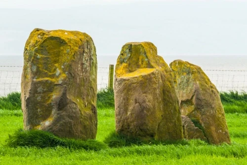
Three stones are arranged in a row in a field at Largizean Farm, south of Stravanan Bay, in the southwestern corner of Bute. The stones are set up on a NW-SE axis and stand 3.5m (10 feet) apart. The row in total is 7.3m long (approximately 24 feet).
Facts and Figures
These irregular whinstone boulders are arranged in height order from the southeast (smallest) to the northwest (tallest). The southeast stone measures 1.9m high x 1.6m wide and is 1.2m thick (6.25 x 5.25 x 3.95 feet).
The middle stone is 1.7m x 1m x 1m (5.6 x 3.3 x 3.3 feet), while the northwestern stone is 1.5m x 1.3m x 0.8m (4.9 x 4.27 x 2.6 feet).
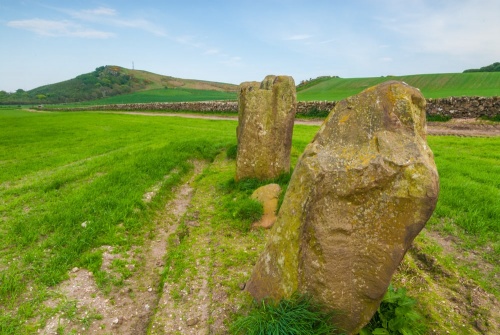
The stone row is at the edge of a field, roughly 500m northwest of the farmhouse. There are limited views of the bay, and on a good day you can see the peak of Goatfell on Arran in the distance.
There is a recumbent fourth stone between the middle stone and the northwest stone, but this appears to be a recent addition, not part of the original row.
The Stravanan Bay Stone Row is classified as a Type 52 row, meaning that it is made up of fewer than 10 large stones. This is the most common type of stone row in Britain, with 39 known examples, many found in Argyll and the Western Isles of Scotland.
Getting There
The stone row is immediately beside a farm track. You can pick up the track at Largizean Farm, on Plan Road, south of Kingarth. The track follows a field boundary north then turns west at the next boundary. You will see the stone row ahead to the right of the path. Please be respectful of farm crops in season!
The West Island Way long-distance footpath passes to the north of the stone row, at the next field boundary, and the Bute Golf Club lies beyond the footpath.
Ordnance Survey Explorer map 662 covers Bute and is the best resource for finding the site.
About Stravanan Bay Stone Row
Address: Largizean Farm, Plan Road, Kingarth, Argyll and Bute, Scotland
Attraction Type: Prehistoric Site
Location: Access via a farm track from Largizean Farm, on Plan Road, south of Kingarth and the Blackpark forest plantation.
Website: Stravanan Bay Stone Row
Location map
OS: NS0846555361
Photo Credit: David Ross and Britain Express
NEARBY HISTORIC ATTRACTIONS
Heritage Rated from 1- 5 (low to exceptional) on historic interest
Blackpark Standing Stones - 0.4 miles (Prehistoric Site) ![]()
St Blane's Church - 1.3 miles (Historic Church) ![]()
Dunagoil Hill Fort - 1.4 miles (Prehistoric Site) ![]()
Kelspoke Castle - 1.6 miles (Castle) ![]()
Scalpsie Bay and Seals - 2.5 miles (Countryside) ![]()
Glencallum Bay Lighthouse - 2.5 miles (Historic Building) ![]()
Mount Stuart - 3 miles (Historic House) ![]()
St Ninian's Chapel - 4.8 miles (Historic Church) ![]()
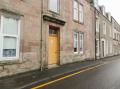
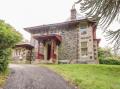
Nearest Holiday Cottages to Stravanan Bay Stone Row:
Nearby accommodation is calculated 'as the crow flies' from Stravanan Bay Stone Row. 'Nearest' may involve a long drive up and down glens or, if you are near the coast, may include a ferry ride! Please check the property map to make sure the location is right for you.