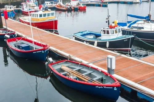
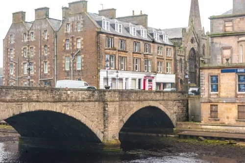
Wick is a historic seaport town in the northeastern corner of Scotland and the largest town in Caithness after Thurso. The town name comes from the Viking word 'vic', meaning a bay, and the Vikings were the first to settle here at the mouth of the River Wick. This was once the busiest herring port in the world, though now the boats in the harbour are just as likely to be pleasure craft.
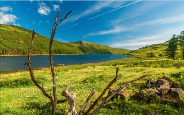
Wick makes an outstanding centre for exploring Caithness and northern Scotland. It is but a short drive up the coast to John o' Groats and the ferry to Orkney.
History
The history of Wick goes back before the arrival of the Vikings, as the presence of an Iron Age hill fort at Garrywhin shows. We know there was a settlement here by the 8th century, when the Irish missionary, St Fergus, arrived to Christianise the residents. Fergus is now the patron saint of Wick, and the annual Fergusmas Fair is named for him.
The Viking settlement at the mouth of the River wick grew up on the north bank. It was part of the vast Norse empire that covered most of Caithness and the Orkneys and extended down the east coast of what is now Scotland.
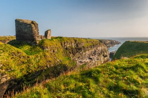
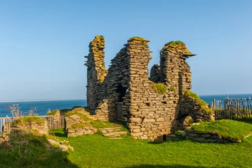
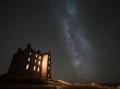
One remnant of the Viking period is the Castle of Old Wick, on the rugged clifftops south of the town. The castle was built sometime around 1160 by Earl Harald Maddadson of Caithness and Orkney. Its prominent position atop high cliffs meant that it was used by fishermen as a landmark for many years.
Sometime between 1390-1406, King Robert III of Scotland granted Wick to Neill Sutherland as a burgh of barony. This essentially raised it to the status of a town, under Sutherland's direct governance.
In 1503 Caithness was granted the right to a sheriff, who was based in Wick.
In 1588 conflict broke out between the Earls of Sutherland and Caithness. Alexander Gordon, the 12th Earl of Sutherland, invaded Caithness and sacked Wick, while the Earl of Caithness and his kinsmen retreated to the shelter of their castle at Girnigoe.
In the following year, 1589, King James VI named Wick a royal burgh under the Earl of Caithness. It was the first and the only royal burgh in Caithness.
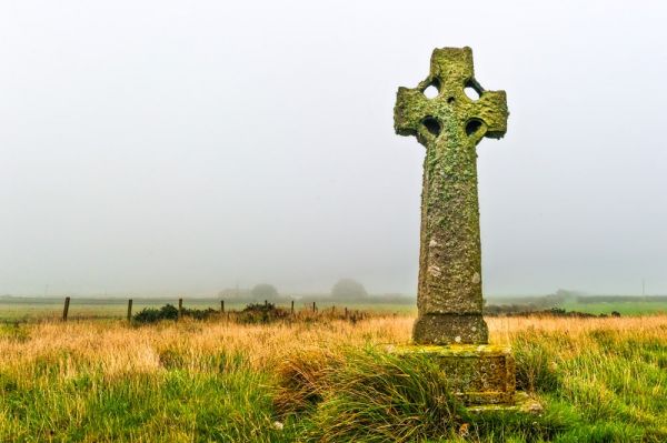
In 1680 the Battle of Altimarlach took place three miles west of Wick between the Campbells of Glenorchy and the Sinclairs of Caithness, both of who claimed the earldom. Altimarlach is generally considered the last feudal clan battle in Scotland. The battle ended in a resounding victory for the Campbell's, but the Sinclairs were awarded the earldom one year later after a legal wrangle.
Wick was transformed beyond all recognition in the late 18th century when it became the centre of the North Sea herring fishery. The story began in 1767 when three local men outfitted a pair of fishing boats and sailed out from Staxigoe, two miles north of Wick in search of herring.
In the latter part of the century, the herring shoals migrated from the west coast of Scotland into the North Sea, and Wick was ideally placed to take advantage of this change. In 1792 the British Fisheries Society sent the Scottish engineer John Rennie to survey possible sites for a herring port on the northeast coast. Rennie recommended Wick, and estimated that building a suitable harbour would cost the Society £14,441 and 9 shillings.
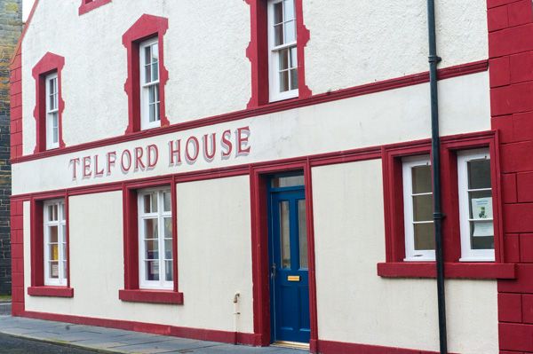
The Society called in another engineer, Thomas Telford, to draw up plans for the new development. While the existing town of Wick was on the north bank of the river, Telford's new development was on the opposite bank. This new settlement was named Pulteneytown after Sir William Pulteney, MP, the Chairman of the British Fisheries Society, one of Telford's most important patrons. Pulteney was also responsible for the Pulteney Bridge in Bath, designed by another Scot, Robert Adam.
Telford's plans for Pulteneytown included two distinct areas; Upper and Lower Pulteneytown. Lower Pulteneytown is laid out as a grid pattern of streets beside the river, with flagstone courtyards here fish could be cured. Many buildings had shops on the ground floor, facing the street, with workers' residences behind and above the shop.
Upper Pulteneytown, by contrast, was laid out as a picturesque residential area centred on Argyle Square. The layout is reminiscent of Bath and is the only complete example of Telford's town planning.
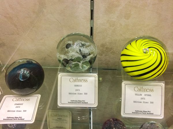
Pulteneytown is perhaps the oldest intentionally planned industrial village anywhere in the world. It has been declared a conservation area in an effort to preserve its heritage. It was also the original home of Caithness Glass, though manufacture has since moved south to Perth. Another popular business in Pulteneytown is the Old Pulteney Distillery, whose single-malt whisky was named the World Whisky of the Year in 2012.
Wick became a destination for thousands of Highlanders displaced from their land during the Clearances. Many descended on Wick in hopes of finding work in the herring fisheries.
Telford may have been a brilliant engineer, but he did not plan on the harbour silting up, nor on the fact that within a few years over 300 ships were vying to moor there. Many began anchoring at small harbours on the northern side of the bay.
The herring fishery was at its height in the late Victorian period, and the biggest catch was made in 1912. however, the shoals of herring were not inexhaustible, and just a few short years later the fishery had dwindled to almost nothing.
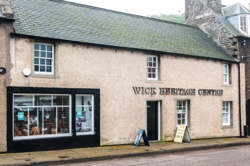
Wick Heritage Centre
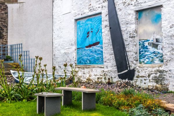
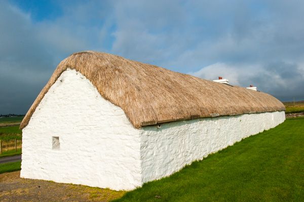
You can learn about the rich history of Wick in the Wick Heritage Centre in Lower Pulteneytown. The Heritage Centre is, not surprisingly, an outstanding source of information on the herring fishery that brought prosperity to the town. Another highlight is the Johnston Collection of historic photographs, documenting the history of Wick for 112 years from 1863-1975.
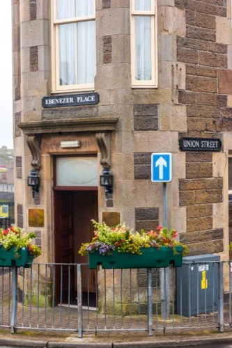
Ebenezer Place
Wick is home to the world's shortest street, as verified by the Guinness Book of World Records. Ebenezer Place measures exactly 2.06 metres (6.76 feet) long, just enough for one doorway.
Memorial Garden
On Bank Row, near the harbour is a memorial garden dedicated to 18 people who lost their lives in two air raids on Wick in the Second World War. On 1 July 1940, a lone German aircraft dropped two bombs on this area, in what is thought to be the first daylight bombing raid on mainland Britain. Fifteen people died that day, including 8 children.
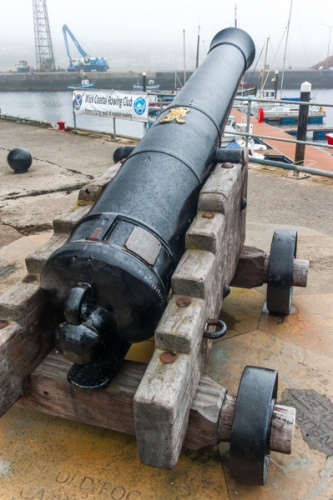
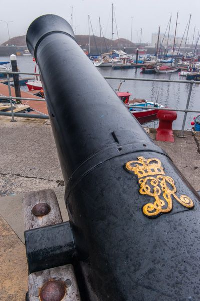
Fog Cannon
On the edge of Wick harbour stands the old Fog Cannon. This cannon was installed in 1881 as a gift of Sir John Pender to the Pulteney Harbour Trust after several tragic events led to fishermen losing their lives in the fog. Pender, a native of West Dunbartonshire, represented Wick and Pulteneytown as a Member of Parliament for 17 years before his death in 1896.
Nearby Attractions
There is an embarrassment of historical riches within easy reach of Wick.
Yarrows Archaeological Trail
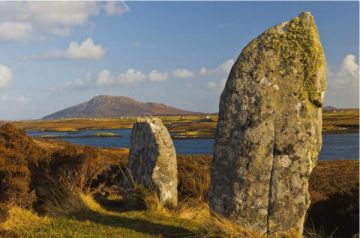
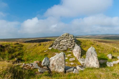
Near Thrumster is a circular trail linking three Neolithic long cairns, two round chambered cairns, a hill fort, a standing stone, Bronze Age hut circles, and an Iron Age broch. Where else can you see such an incredible wealth of prehistoric sites in two short miles?
More on the Yarrows Archaeological Trail
Cairn o' Get
And speaking of prehistoric remains, there is Cairn o' Get, a Neolithic burial cairn near Loch Watenan, located in a landscape of hut circles, two brochs, and a stone row.
More on Cairn o' Get

Castle of Old Wick
On the cliffs just south of Wick stands the ruins of one of the earliest castles in Scotland. The castle stands on a rocky promontory, defended on the landward side by a ditch and on the other three sides by the sheer cliffs.
Castle Sinclair Girnigoe
The imposing ruins of this once-mighty castle cling to the rocky cliffs at the southeastern end of Sinclair's Bay, near Noss Head. The castle was probably begun in the late 14th century by the Sinclairs, Earls of Orkney and later to become the Earls of Caithness. Much of what we see today dates from the 15th and 16th centuries. In 1588 the castle was besieged by the Earl of Sutherland, but the defenders held out for 12 days before Sutherland gave up.
Oliver Cromwell's soldiers made their base here in 1651 and left the castle in poor condition. What remains, however, is impressive. Castle Sinclair Girnigoe is now undergoing restoration by the Clan Sinclair Trust. It is the only castle in the world to be listed by the World Monument Fund, as one of the 100 most endangered sites in the world.
More on Castle Sinclair Girnigoe
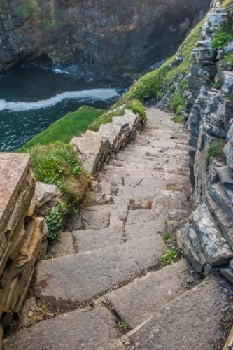
Whalligoe Steps
At Whaligoe is a remarkable reminder of the heady days of the Wick herring fishery. Flights of incredibly steep stone steps have been carved into the solid rock of the cliffs to make a staircase down to a minuscule harbour. When Thomas Telford surveyed the narrow inlet at Whaligoe he dismissed it as unsuitable for herring boats.
Captain David Brodie disagreed, and in 1793 he paid a local stonemason to carve over 300 steps into the cliff. Hardy visitors can descend the steps today, and marvel at the bravery of the fishermen and women who worked here.
More on Whaligoe Steps
Keiss Castle
Another picturesque ruin is Keissd Castle, a 16th-century tower house built by the Earl of Caithness at the northern end of Sinclair's Bay. The castle stands within the grounds of the 18th-century 'new' Keiss Castle, but can be reached via a public footpath along the cliffs from nearby Keiss village.
More on Keiss Castle

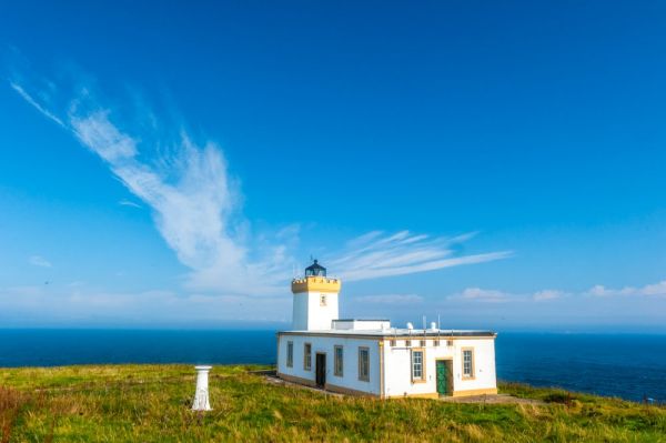
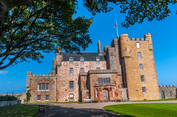
Further north, near John o' Groats, is Castle of Mey, once owned by the Queen Mother. A lane near the John o' Groats post office leads to Duncansby Head, where a lighthouse designed by David Stevenson looks out over the Pentland Firth, a treacherous stretch of water once known as 'Hell's mouth' by mariners. A trail leads along the cliffs to spectacular sea stacks.
Getting There
Wick is located at the junction of the A882 and the A99. There are several free car parks, including the Riverside Car Park on Macleay Lane
I once had the pleasure of staying for a week in a self-catering cottage just south of Wick, and absolutely loved the area. If you enjoy history, you'll be spoilt for a choice of attractions to explore, and if you enjoy spectacular scenery, you've come to the right place!
More Photos
About Wick
Address: A99, Wick, Caithness, Scotland
Attraction Type: Town
Location: At the junction of the A882 and the A99 in the northeast corner of Scotland.
Location map
OS: ND364507
Photo Credit: David Ross and Britain Express
NEARBY HISTORIC ATTRACTIONS
Heritage Rated from 1- 5 (low to exceptional) on historic interest
Wick Heritage Centre - 0.1 miles (Museum) ![]()
Castle of Old Wick - 1.3 miles (Castle) ![]()
Altimarlach Battlefield and Cross - 1.6 miles (Countryside) ![]()
Castle Sinclair Girnigoe - 2.7 miles (Castle) ![]()
Yarrows Archaeological Trail - 5.9 miles (Prehistoric Site) ![]()
Keiss Castle - 6.7 miles (Castle) ![]()
Cairn o' Get - 6.8 miles (Prehistoric Site) ![]()
Whaligoe Steps - 7 miles (Historic Building) ![]()
Nearest Holiday Cottages to Wick:
Nearby accommodation is calculated 'as the crow flies' from Wick. 'Nearest' may involve a long drive up and down glens or, if you are near the coast, may include a ferry ride! Please check the property map to make sure the location is right for you.
John o Groats, Highlands and Islands
Sleeps: 12
Stay from:£1,930 - £5,827